The Complete Hehuanshan Guide: Public Transport, Driving, How to Plan 2–3 Days, and Where to Stay
All content is for inspiration only. Use Taiwan Hikes' suggestions at your own risk. We are not responsible for any losses, injuries, or damages.
Table of Contents:
- Hehuanshan's 11 Peaks: Taiwan's Most Accessible, Permit-Free High-Mountain Hikes (With Maps)
- How to Get to Hehuanshan: Public Transport, Parking, and Where to Stay During Your Hehuanshan Hike
- The Peaks Worth Planning Around on a Tight Schedule — Main, East, North, Mt. Shimen
- The One Real Challenge — West Peak (out-and-back / Huagang)
- The Rest — South Peak, Hehuanjian, Shimen North, Little Qilai, Haha, Nanhaha
- The 2–3 Day Itinerary by Bus
- Before You Go: Road Closures, Winter Rules, Weather, Drones & the Rules Nobody Mentions
- About Hehuanshan and the Only Ski Resort in Taiwan
- Related Posts
Hehuanshan's 11 Peaks: Taiwan's Most Accessible, Permit-Free High-Mountain Hikes (With Maps)
- Hehuanshan Main Peak Trail 合歡山主峰, 3,417 meters (11,210.6 feet) above sea level, and is listed among 100 Peaks. There is a Class 3 Triangulation Stone on the top. Distance: a 3.6 km (2.2 miles) out-and-back trail.
- Hehuanshan East Peak Trail 合歡山東峰, 3,421 meters (11,224 feet) above sea level and is listed among 100 Peaks. Distance: a 2 km (1.2 miles) out-and-back trail.
- Hehuanshan North Peak Trail 合歡山北峰, 3,422 meters (11,227 feet) above sea level. Listed in 100 Peaks. Distance: a 3.8km (2.4 miles) out-and-back trail.
- Hehuanshan West Peak Trail 合歡山西峰, 3,145 meters (10,318.2 feet) above sea level. Listed in 100 Peaks. Distance: a 13.4km (8.3 miles) out-and-back trail. Hehuanshan North Peak is on this route if you hike to the West Peak.
- Mt. Shimen (Shimenshan) Trail 石門山, 3,237 meters (10,620 feet) above sea level and listed in 100 Peaks. There is a Class 3 Triangulation Stone on the top. Distance: a 1.4 km (0.9 mile) out-and-back trail.
- Mt. Shimen North Peak 石門山北峰, 3,275 meters (10,744.7 feet) above sea level. Distance: a 1.7 km (1.1 miles) out-and-back trail.
- Mt. Haha 哈哈山, 3,286 meters (10,780.8 feet) above sea level.
-
Mt. Nanhaha or Mt. South Haha 南哈哈山, 3,285 meters (10,777.5 feet) above sea level.
Mt. Shimen North Peak, Mt. Haha, and Mt. Nanhaha are on the same route, and Mt. Shimen North Peak is the farthest point on this route. The distance of this out-and-back route is 1.7 km (1.1 miles). - Hehuanshan Point Trail (Mt. Hehuanjian) 合歡尖山, 3,217 meters (10,554.4 feet) above sea level. Distance: a one km (0.6 miles) out-and-back trail.
- Xiaoqilai (Little Qilai) Trail 小奇萊步道. The highest point of this trail is 3,150 meters (10,334.6 feet) above sea level. Distance: a 2.8km (1.7 miles) out-and-back trail.
- Hehuanshan South Peak 合歡山南峰, 3,220 meters (10,564 feet) above sea level. Distance: a 1 km (0.6 miles) out-and-back trail from Kunyang Parking Lot 昆陽停車場.
How to Get to Hehuanshan: Public Transport, Parking, and Where to Stay During Your Hehuanshan Hike
Buses from Taichung to Puli, and to Hehuanshan
| Bus No. | Fare | Taichung HSR (Platform 3, Exit 5) |
Puli Bus Station | Qingjing Farm / Guest House |
Hehuanshan | Note |
|---|---|---|---|---|---|---|
| 6670 | NT$187 | ✓serves Taichung HSR | ✓serves Puli | |||
| 6670A | NT$118 | ✓serves Taichung HSR | ✓serves Puli | |||
| 6670C | NT$144 | ✓serves Taichung HSR | ✓serves Puli | |||
| 6670D | NT$118 | ✓serves Taichung HSR | ✓serves Puli | |||
| 6670G | NT$187 | ✓serves Taichung HSR | ✓serves Puli | |||
| 6670H | NT$118 | ✓serves Taichung HSR | ✓serves Puli | Fastest | ||
| 6664 | NT$123 | ✓serves Puli | ✓serves Qingjing Farm | |||
| 6658 | NT$123 | ✓serves Puli | ✓serves Qingjing Farm | |||
| 6659 | NT$123 | ✓serves Puli | ✓serves Qingjing Farm | |||
| Qingjing Shuttle | NT$233 | ✓serves Taichung HSR | ✓serves Puli | ✓serves Qingjing Farm | Get a number at the Nantou Bus counter at Taichung HSR Station. If passengers pay with an IC card, they need to swipe the card 4 times. | |
| 6658A | NT$95 | ✓serves Qingjing Farm | ✓serves Hehuanshan | Book round-trip seats in advance. No bicycles on board. |


Parking Lots and Payment Methods
Swipe the table sideways to see all columns.
| Parking lot | Mon–Thu (car) | Fri–Sun & holidays (car) | Daily cap | Free buffer | Notes |
|---|---|---|---|---|---|
| Kunyang, Wuling & Mt. Hehuan (Hehuanshan) Parking Lots | NT$50 / hr | NT$60 / hr | NT$300 | 15 min | Motorcycles NT$20 per entry |
| Xiaofengkou Parking Lots | NT$20 / hr | NT$60 / hr | Weekday: none Weekend: NT$300 |
15 min | Motorcycles NT$20 per entry |
| Hehuanjian Temporary Parking Lots | Free | Free | N/A | Parking space is limited here. If full, use the lot near the visitor center. | |
| Yuanfeng Visitor Center / Dark Sky Park | NT$50 flat / entry | NT$50 flat / entry | 10 min | Overnight car-stay NT$300. Shuttles & medium buses park free 08:00–17:00. |


Where to Stay - Option 1: Stay at Songsyue Lodge 松雪樓

Where to Stay - Option 2: Stay at Ski Hostel (滑雪山莊) - Currently Under Renovation

Where to Stay - Option 3: Stay at Qingjing (Cingjing) Farm 清境農場

The 2–3 Day Itinerary by Bus

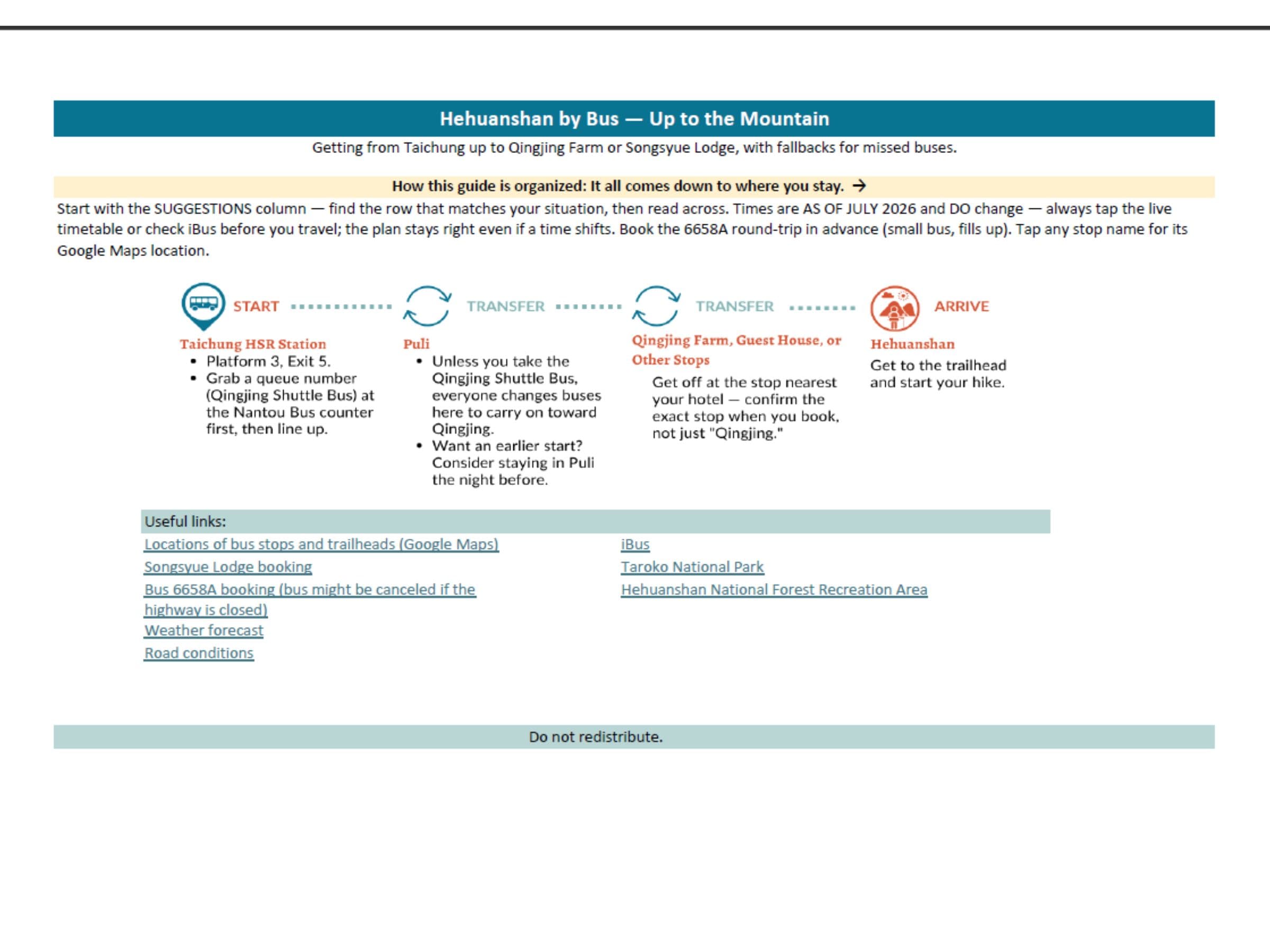
Planning Hehuanshan by bus?
Getting there without a car means threading buses across three transfers — and
booking a lodge and a small mountain bus that fill up weeks ahead, in the right
order. Miss one connection or one booking window and the trip unravels.
The
Hehuanshan by Bus itinerary maps all of it: a timed 2–3 day plan
for both bases (Songsyue or Qingjing), which bus to catch and when, the fallbacks
for a full bus, and the exact booking countdown — so you reserve everything in the
right order. Days of untangling scattered timetables, condensed into a plan you
follow in minutes.
The Peaks Worth Planning Around on a Tight Schedule — Main, East, North, Mt. Shimen
Hehuanshan Main Peak
- The closest bus stop: Wuling Bus Stop. Walking distance from the bus stop to the trailhead: 0.8 km
- The closest parking lot: Wuling Parking Lot. Walking distance from the parking lot to the trailhead: 0.8 km
- Elevation: 3,417 meters (11,211 feet) above sea level
- Trail distance and route type: 1.8 km and out-and-back
- Difficulty level:

- Estimated time: 2 hours
- Also listed in Taiwan's 100 Peaks


No vehicles, motorcycles, scooters, or bicycles are allowed to enter.


Hehuanshan East Peak
- The closest bus stop: Songsyue Lodge Stop. Walking distance from the bus stop to the trailhead: 0.45 km
- The closest parking lot: Wuling Parking Lot. Walking distance from the parking lot to the trailhead: 0.55 km
- Elevation: 3,421 meters (11,224 feet) above sea level
- Trail distance and route type: 1.056 km and out-and-back
- Difficulty level:

- Estimated time: 2-3 hours
- Also listed in Taiwan's 100 Peaks


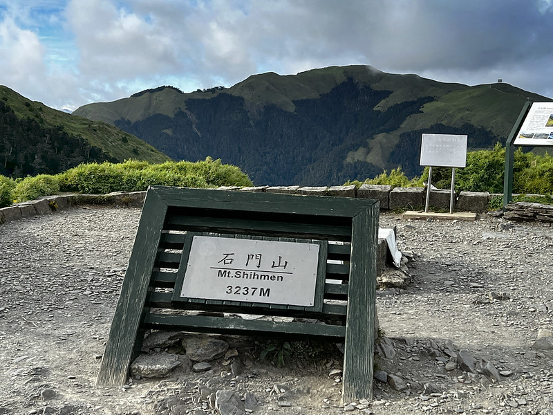
Mt. Shimen (Shimenshan), the Easiest 100 Peaks to Hike in Taiwan
- The closest bus stop: Shimenshan Stop. The trailhead is next to the bus stop.
- The closest parking lot: Hehuan Point (Hehuanjian) Parking Lot. The trailhead is accross the parking lot.
- Elevation: 3,237 meters (10,620 feet) above sea level
- Trail distance and route type: 0.8 km and out-and-back
- Difficulty level:
- Estimated time: 1 hour
- Also listed in Taiwan's 100 Peaks


Hehuanshan North Peak
- The closest bus stop: Xiaofengkou Stop. Walking distance from the bus stop toward north to the trailhead: 0.4 km
- The closest parking lot: Xiaofengkou Parking Lot. Walking distance from the parking lot to the trailhead: 0.5 km
- Elevation: 3,422 meters (11,227 feet) above sea level
- Trail distance and route type: 1.9 km and out-and-back
- Difficulty level:

- Estimated time: 3-4 hours
- Also listed in Taiwan's 100 Peaks


The One Real Challenge — West Peak (out-and-back / Huagang)
- The closest bus stop: Same as Hehuanshan North Peak
- The closest parking lot: Same as Hehuanshan North Peak
- Elevation: 3,145 meters (10,318 feet) above sea level
- Trail distance and route type: 13.4 km (8.3 miles), out-and-back route with over 1,300 meters of ascent and descent
- Difficulty level:

- Estimated time: 10-14 hours
- Also listed in Taiwan's 100 Peaks

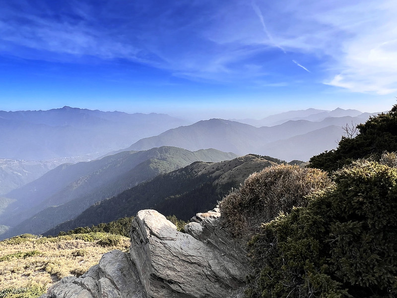
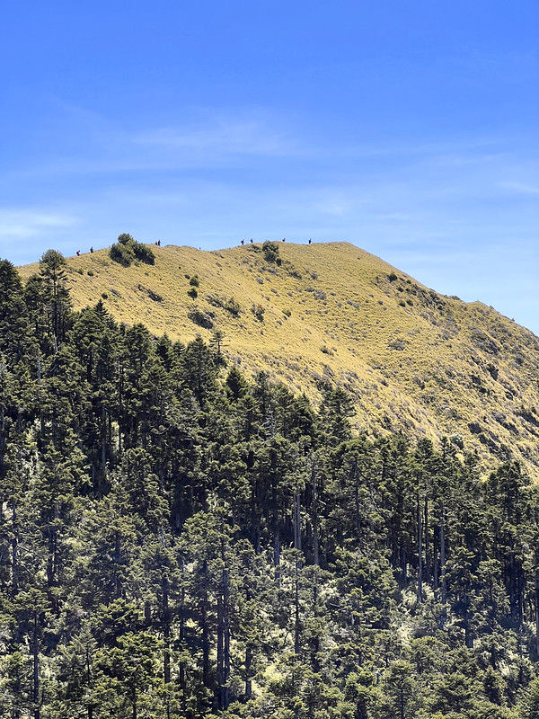
Sunrise from Hehuanshan North Peak


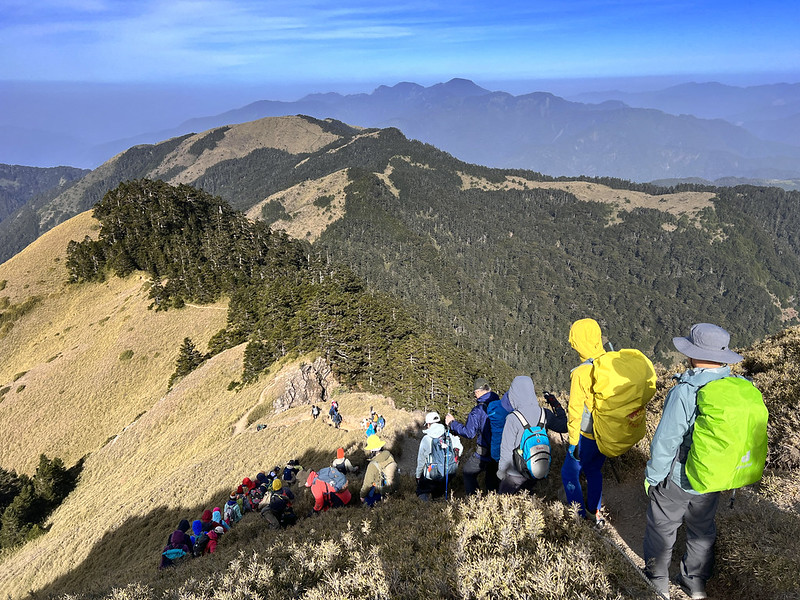
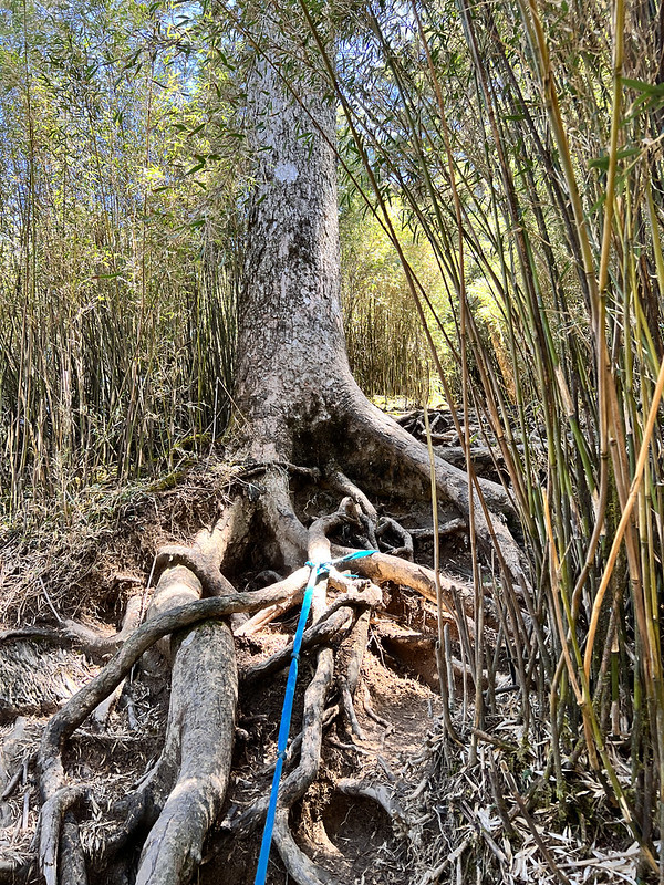
The Nortorious 7 Ups And 8 Downs 七上八下 to Hehuanshan West Peak




The Rest — South Peak, Hehuanjian, Shimen North, Little Qilai, Haha, Nanhaha
Hehuanshan South Peak
- The closest bus stop: Kunyang Stop. The trailhead is across the road.
- The closest parking lot: Kunyang Parking Lot. The trailhead is across the road.
- Elevation: 3,220 meters (10,564 feet) above sea level
- Trail distance and route type: 0.5 km and out-and-back
- Difficulty level:
- Estimated time: within 1 hour


Hehuanjian or Hehuan Point Trail
- The closest bus stop: Songsyue Lodge Stop
- The closest parking lot: Songsyue Lodge Lot.
- Elevation: 3,217 meters (10,554.5 feet) above sea level
- Trail distance and route type: 0.5 km, point-to-point or out-and-back
- Difficulty level:
- Estimated time: within 1 hour


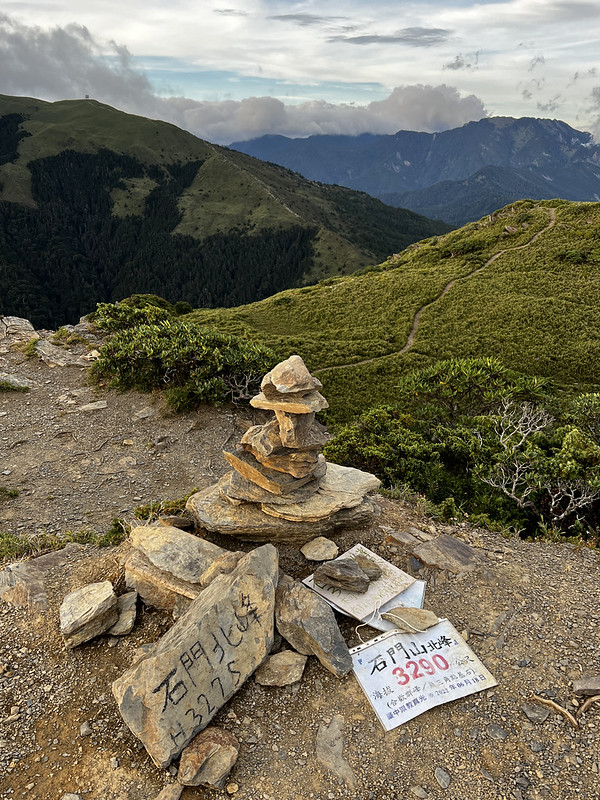
Mt. South Haha (Nanhaha), Mt. Haha, and Mt. Shimen North Peak
- The closest bus stop: Shimenshan Stop. The distance from the stop to Kenanguan 克難關 near the 34.5 km marker, aka Dafengkou 大風口 Big Wind Gap, is 1 km.
- The closest parking lot: Hehuanjian Parking Lot. The distance from the stop to Kenanguan trailhead is 1 km.
- Mt. South Haha Elevation: 3,285 meters (10,777.6 feet) above sea level
- Mt. Haha Elevation: 3,287 meters (10,784 feet) above sea level
- Mt. Shimen North Peak Elevation: 3,275 meters (10,744.8 feet) above sea level
- Trail distance and route type: 0.85 km and out-and-back
- Difficulty level:
- Estimated time: 1-2 hours

Xiaoqilai Trail to Mt. Xiaoqilai
- The closest bus stop: Songsyue Lodge Stop. Walk 0.5 km to Mt. Qilai trailhead.
- The closest parking lot: Songsyue Lodge Lot. Walk 0.5 km to Mt. Qilai trailhead
- Elevation: 3,153 meters (10,344.5 feet) above sea level
- Trail distance and route type: 1.4 km and out-and-back
- Difficulty level:
- Estimated time: 2 hours


Planning Hehuanshan by bus?
Getting there without a car means threading buses across three transfers — and
booking a lodge and a small mountain bus that fill up weeks ahead, in the right
order. Miss one connection or one booking window and the trip unravels.
The
Hehuanshan by Bus itinerary maps all of it: a timed 2–3 day plan
for both bases (Songsyue or Qingjing), which bus to catch and when, the fallbacks
for a full bus, and the exact booking countdown — so you reserve everything in the
right order. Days of untangling scattered timetables, condensed into a plan you
follow in minutes.
Before You Go: Road Closures, Winter Rules, Weather, Drones & the Rules Nobody Mentions
1. Winter Driving in the Hehuanshan Area: Ice-prone Sections and Traffic Control
- Provincial Highway 14A (Wushe branch): km 37, km 38.7–39, and km 34.5 (Kenan Pass) down to km 29.3 (Kunyang)
- Highway 14A, which connects Wushe and Dayuling, experiences significant traffic jams during snowfalls and on public holidays.
- During the snow season, if the road has snow or ice, traffic control measures are implemented. Highway 14A between Dayuling and Cuifeng is closed to vehicles from 6:00 PM to 7:00 AM.
- Always check current road conditions before and during your trip, whether it's winter or not.
2. What's Banned in Hehuanshan
- No stoves, open fires, fireworks, cooking, or BBQ — anywhere in the Hehuanshan area
- No smoking — the entire recreation area is a designated no-smoking zone (Kunyang, Wuling, Songsyue Lodge, Hehuan Lodge, East Peak, Hehuanjian, and all scenic spots)
- No pets — no dogs, cats, or other mammals. Hehuanshan is in a rabies-control zone; the ban protects both wildlife and your animal.
- No camping or pitching tents outside designated areas
- No picking plants, hunting, fishing, polluting water, carving on rocks/trees/signs, or playing loud music/sound devices
- No firecrackers, fireworks, or joss paper
- No parking outside marked areas, and don't block reserved spaces
- No entering closed areas, or any area during its closed hours.
3. Can I Fly A Drone in Hehuanshan?
- Where to apply: Go to the Tarako National Park's Flying Drone Application page and apply online.
- When to apply: Apply 7 to 60 days before your shooting date.
- How long the permit lasts: One permit covers a shooting window of up to 30 days.
- What do I do with the permit: After approval, carry your permit and your ID while filming, in case of inspection.
Rules While Flying A Drone
- You must comply with Taiwan's Civil Aviation Act and all related drone laws. Airflow and GPS signal are often unstable up here — mind your altitude, speed, volume, wind, and signal. Airflow and GPS signal are often unstable up here — mind your altitude, speed, volume, wind, and signal.
- No drone racing, and don't disturb wildlife or endanger other visitors.
- Do not fly over Hehuan Creek (合歡溪) — it's a restricted spot.
- You're liable for any injury or damage to facilities, landscape, or natural resources your drone causes.
- If the location is outside the park or involves another agency's facilities, residents' homes, or a business's property, obtain consent first.
- Roads, trails, and viewpoints may close due to heavy rain, earthquakes, or snow. Check the park website for current closures before entering. An approved spot that's closed on the day is treated as not approved for that period — the permit doesn't override a closure.
- Taroko will refuse your drone applications for 2 years and pursue legal penalties.
4. Always Check These Before You Depart
- Weather forecast from the Central Weather Administration
- Traffic and road conditions from the Central Region Branch Office of the Highway Bureau
- Provincial Highway Real Time Information Service
- The Taroko National Park
- Hehuanshan National Forest Recreation Area
- iBus Information Service. You can also download the app in your phone.
About Hehuanshan and the Only Ski Resort in Taiwan