Jiemaosi Route to Jiaming (Chiaming) Lake Trail (No Cabin Permits Required)
The Jiemaosi route is a popular alternative for hikers who wish to venture to Jiaming Lake. Unlike the
traditional route, which is difficult to get a bed at the Jiaming Lake Cabin, obtaining a permit for this
route is straightforward, allowing hikers to focus on the adventure ahead.
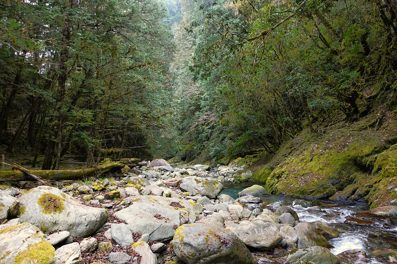
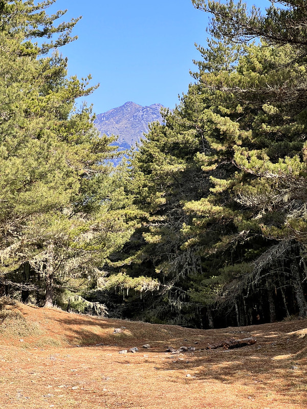
As you traverse this path, nature unveils its magnificence. The route winds through enchanting forests with a
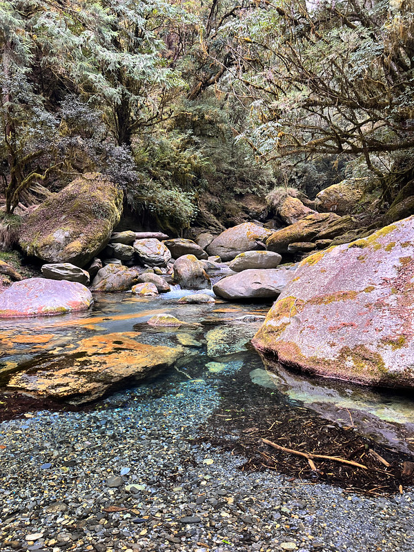
pleasant encounter with the crystal-clear Xinwulu Creek, painting a scene out of a fairy tale.
Note: please cross the river with extra caution if the water is high or after rain.
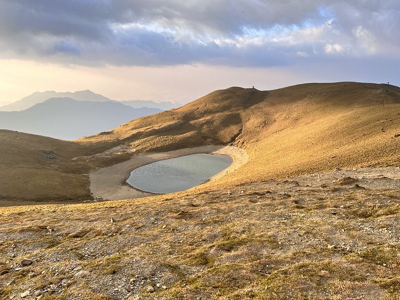
But the crowning moment waits at the end: Jiaming Lake at dawn. The world seems to pause as the first rays of
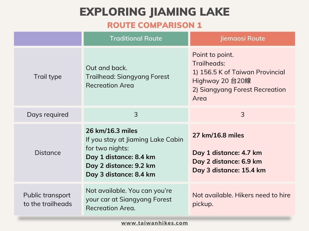
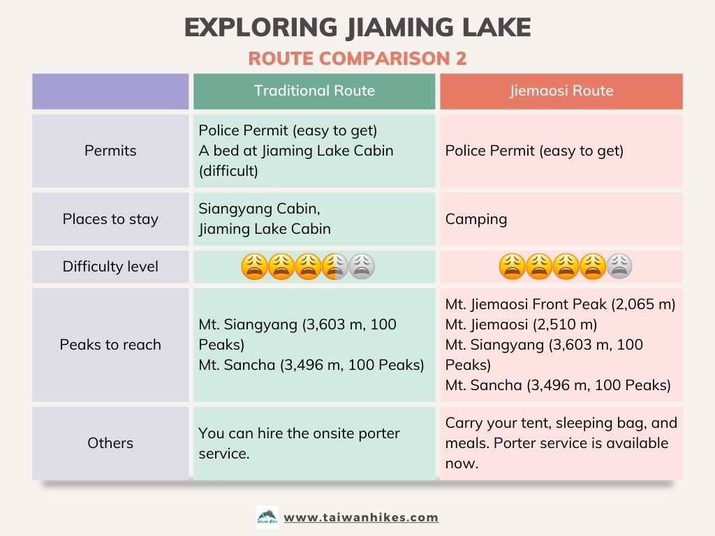
the sun dance upon the water's surface and a gorgeous glow in the sky. You will find a comparison table of the
traditional and Jiemaosi routes below.
Important: Due to the April 3, 2024 earthquake, typhoons, and ongoing landslides affecting the railway
and coastal highway, travelers should take a train from Taipei via the Western Main Line to Kaohsiung, then
transfer to the South Link Line to Chishang, Taitung. If driving, use the highways on the west side of Taiwan.
Disclaimer:
All content is for inspiration only. Use Taiwan Hikes' suggestions at your own risk. We are not responsible for any losses, injuries, or damages.
Taiwan Hikes may include affiliate links. When you purchase through these links, you support our ability to continue providing FREE content — at no additional cost to you.
Table of Contents:
- Exploring Jiaming Lake: A Comparison of the Traditional and Jiemaosi Routes
- Trail Information: The Jiemaosi Route to Jiaming Lake
- Transport to the Jiemaosi Trailhead, Trail Map, GPX Data, and How to Apply for Permits
- Free Guides: How to Apply for Hiking Permits in Taiwan. Or Hire Me!
- Captivating Moments on the Jiemaosi Route: Journey through Enchanted Forests and Crystal-clear Rivers
- The Story of Jiemaosi: History, Significance, and What to Expect
- Related Posts
Exploring Taiwan? Save Time with the Ultimate 2025 Hiking Guide! Discover the top hikes in every city and
county across Taiwan—all accessible by public transport (bus links available). We've spent 50+ hours
researching the best trails and transit options, so you can skip the hassle and start your adventure!
Exploring Jiaming Lake: A Comparison of the Traditional and Jiemaosi Routes 傳統路線 V.S. 戒茂斯
Jiemaosi Trail was the indigenous Bunun people's ancient hunting trail. Due to its easy application process
and pristine scenery, Jiemaosi Route has become another popular path to Jiaming Lake.
After doing two routes to Jiaming Lake, my favorite is the Jiemaosi one. I enjoy Xinwulu Creek and the
stunning forests very much. Camping by the river was fantastic. I sat by the river long to enjoy the running
water and tranquility.
Yet, this is also a more challenging route, especially on the last day of the hike.
Trail Information: The Jiemaosi Route to Jiaming Lake
Trail Name: From Jiemaosi to Jiaming Lake
Distance: 27 km (16.8 miles)
Route type: Point-to-point
Days/Hours Needed: 3 days
Total Ascent/Descent: 2,835m/2,379m
Best Time to Go: All year round except when typhoons come.
Permits: Police Permit required
Difficulty Level:
Distance: 27 km (16.8 miles)
Route type: Point-to-point
Days/Hours Needed: 3 days
Total Ascent/Descent: 2,835m/2,379m
Best Time to Go: All year round except when typhoons come.
Permits: Police Permit required
Difficulty Level:

Peaks or Places to Reach
- Mt Jiemaosi Front Peak 戒茂斯山前峰, 2,065 meters (6,745.4 feet) above sea level. No views.
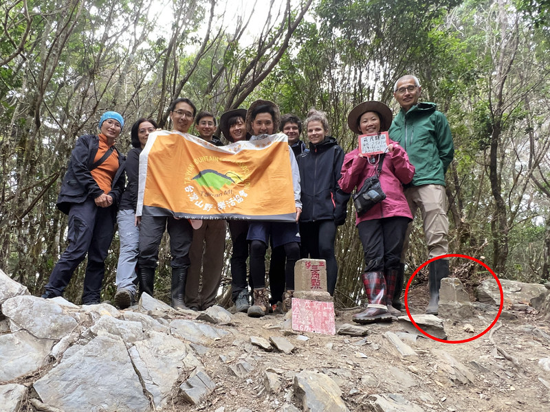
- Mt. Jiemaosi 戒茂斯山, 2,510 meters (8,235 feet) above sea level. There's a Class 3 Triangulation Stone and another “Shan 山 (mountain)” Triangulation Stone at the peak.
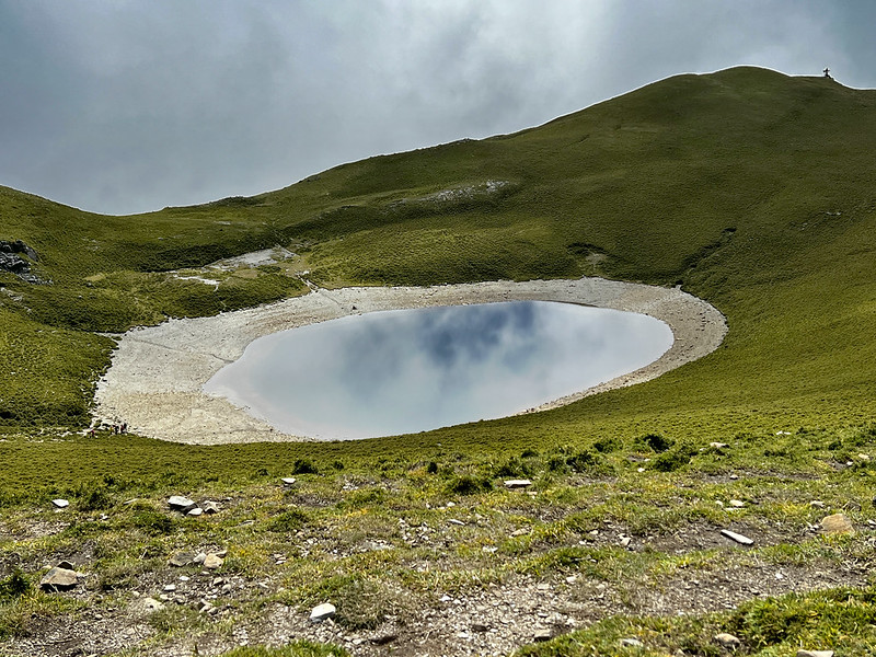
- 3. Jiaming Lake 嘉明湖, 3,310 meters (10,859.6 feet). The second highest alpline lake in Taiwan. The highest one is Cuei Pond near Xueshan.
- 4. Mt. Sancha 三叉山, 3,496 meters (11,469.8 feet) above sea level. There is a Class 1 Triangulation Stone at the peak.
- 5. Mt. Siangyang 向陽山, 3,602 meters (11,817.5 feet) above sea level. There is a Class 3 Triangulation Stone.
Available Campsites (No Need to Apply):
- Xinwulu Creek Campsite
- Volleyball Court Campsite: need to carry water
- Soccer Court Campsite: need to carry water
- Golf Court Campsite: need to carry water
- Hunter Campsite
Additional Information:
- Camping by Jiaming Lake is not allowed.
- Many sections are exposed to the sun. Please do sun protection.
- It can still be cold in summer.
- Pay extra attention when crossing Xinwulu Creek when it rains or after the rain. The water can be very high and dangerous.
Transport to the Jiemaosi Trailhead, Trail Map, GPX Data, and How to Apply for Permits
No Public Transport to Jiemaosi Trailhead
The closest bus stop is at Lidao Tribal Village 利稻部落, which is around 16 km (10 miles) away from the Jiemaosi
Trailhead. Hiring a pickup is a better option.
The trailhead is at 156.5 K of Taiwan Provincial Highway 20 台20線.
Trail Map and GPX Data
Route map for Jiaming Lake - Jiemaosi Updated by Anusha Lee on plotaroute.com
Click Menu in the map to download, print, or share the map.
You can see more options after clicking the Play button.
Click to change the speed to meet your pace.
You can see more options after clicking the Play button.
Click
 to change the speed to meet your pace.
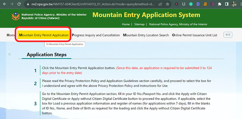
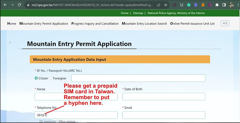
How to Apply for Police Permits
Jiaming Lake, Mt. Sancha, and Mt. Siangyang do not belong to any national park in Taiwan. So, hikers only need
to apply for a Mountain Entry Permit (let's call the
police permit).
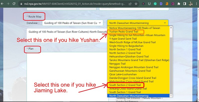
You will find both Jiaming and Chiaming Lake spellings on this database. If you also want to hike to Mt.
Sancha and Mt. Siangyang (most people do), please search for Chiaming with an uppercase C, and
Jiemaosi with an uppercase J. Both Jiaming and Chiaming Lake refer to the same lake but with different
spellings. Welcome to the translation hell.
Get Free Guides on Public Transport and Applying for Permits. Or Hire Me!
Free Bus Guides to Hike Popular Mountains in Taiwan
Taking buses to hike in Taiwan can be tricky if you don't read Chinese. Therefore, I've made several public transport guides to help you get to the trailheads. Or click the
button below to see more details.
Captivating Moments on the Jiemaosi Route: Journey through Enchanted Forests and Crystal-clear Rivers
Brief itinerary
Day 1: Jiemaosi Trailhead ➔ Mt. Jiemaosi Front Peak ➔ Mt. Jiemaosi ➔ Xinwulu Creek
Campsite
Day 2: Xinwulu Campsite ➔ Volleyball Court Campsite ➔ Soccer Court Campsite ➔ Golf
Court Campsite ➔ Hunter Campsite
Day 3: Hunter Campsite ➔ Jiaming Lake ➔ Mt. Sancha ➔ Jiaming Lake Cabin ➔
Junction to Mt. Siangyang ➔ Mt. Siangyang ➔ Junction to Mt. Siangyang ➔ Siangyang Famous
Tree ➔ Black Water Pond ➔ Siangyang Cabin ➔ Siangyang Forest Recreation Area/Checkpoint
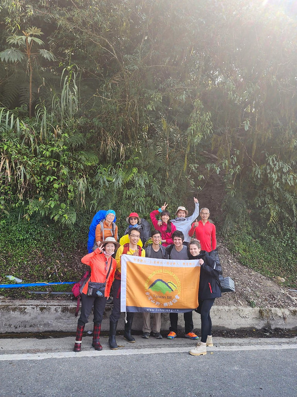
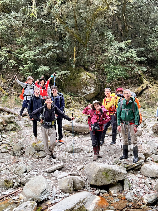
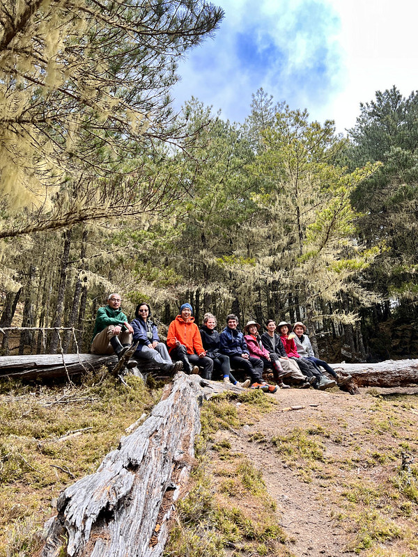
I did this hike with LOHAS in March 2023, and we stayed in Xiulin, Hualien 花蓮秀林 before the trek. It
was a long drive, so we left the hostel around 6 a.m. We took a short break at a 7-11 Convenience Store,
Chulai Branch 初來門市, which might be the one among the branch stores with the best view.
After driving for almost 4 hours, we finally reached the Jiemaosi Trailhead at 156.5 K of Taiwan Provincial
Highway 20 台20線 at 10:07.
Day 1: Enchanted Forest and Beautiful Xinwulu Creek 新武呂溪
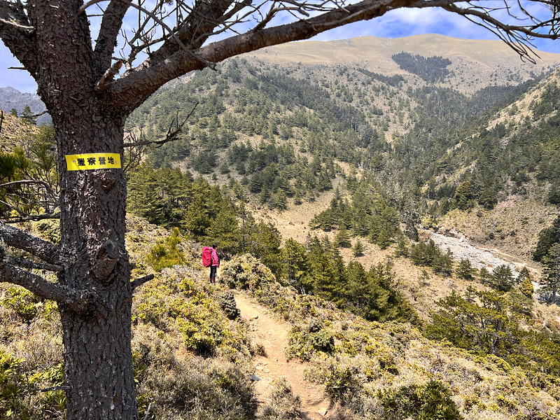
10:22 We were ready to hike. We had a steep start, but it wasn't too bad.
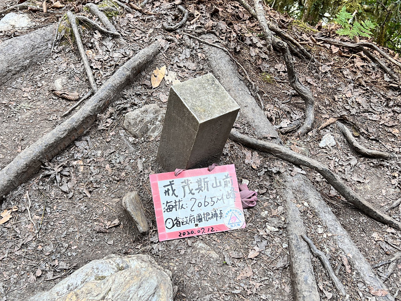
10:51 We reached the first peak, Mt. Jiemaosi Front Peak, 2,065 meters.
11:28 I finally saw the trail marks and passed 004.
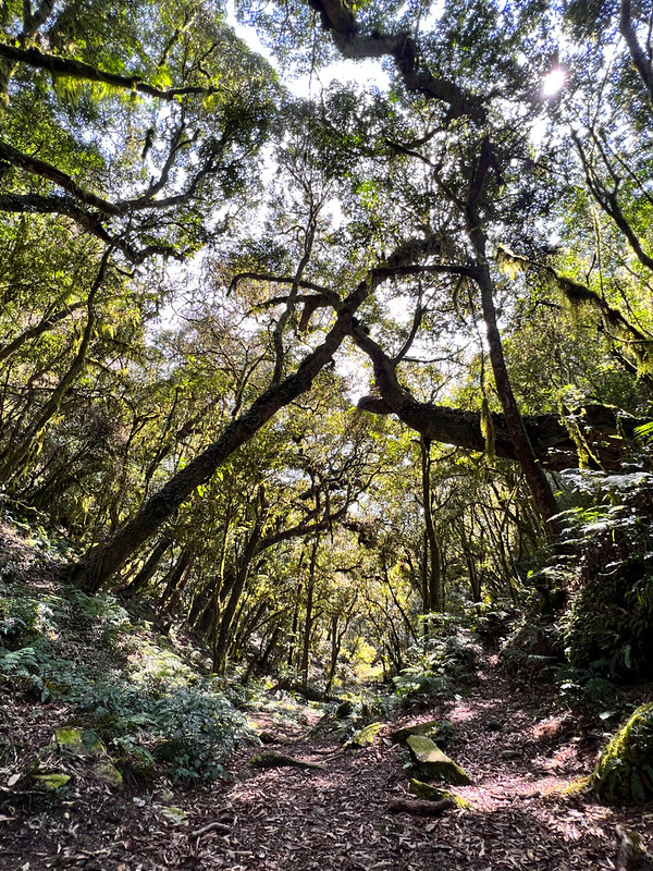
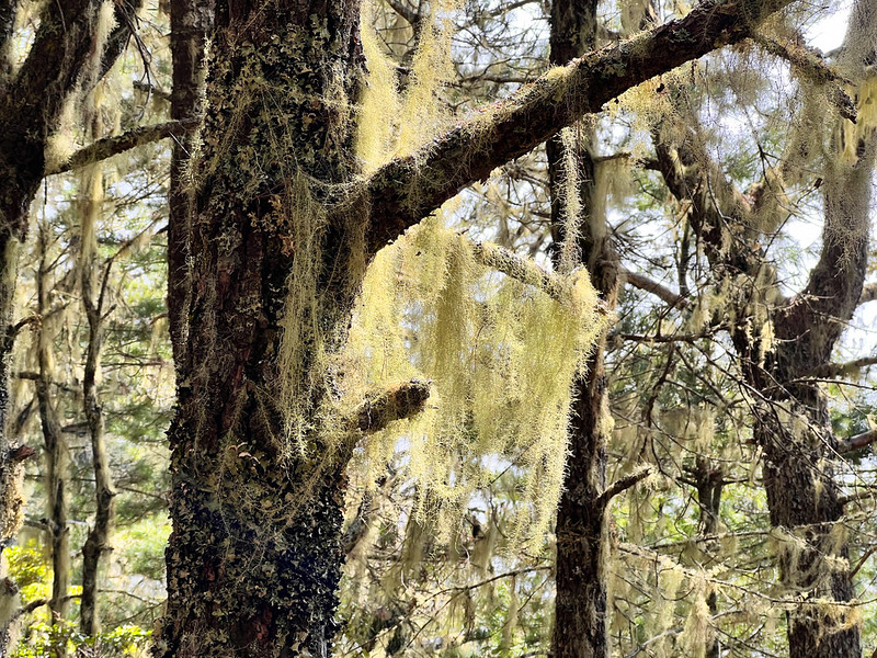
Usnea 松蘿 started showing up all over the trees. With the fog flowing in the forest, it felt like we trespassed
fairy's home.
11:49 We had a short lunch break.
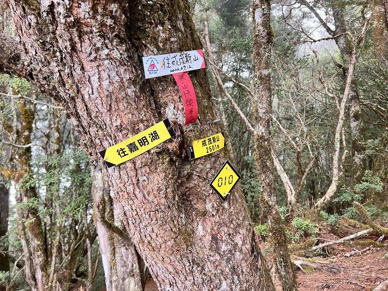
13:10 We reached the junction with the 010 mark. This is the junction to Mt.
Jiemaosi. We left our backpacks at the junction.
13:20 Within ten minutes, we bagged our second peak, Mt. Jiemaosi, which has
two triangulation stones. One of them is damaged.
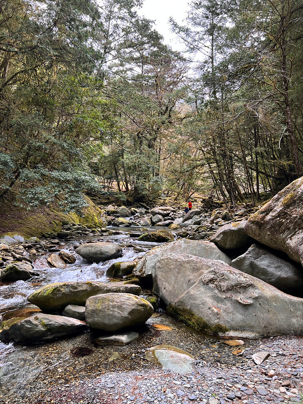
14:12 We crossed our first section of Xinwulu Creek. The water was crystal
clear with a light shade of blue or green.
Soon, we crossed our second river crossing. The creek looked even more amazing.
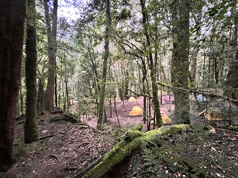
14:28 We reached our campsite. Our guides, Xiao Tsai and Rose, started
preparing dinner.
Beside the babbling stream where I sat, I tried to capture photos and keep this memory, but witnessing this in
person is always the best.
Here, without any bar of phone receptions, I finally embraced nature and let the creek and forests take away
my thoughts.
Day 2: More Incredible Coniferous Forests Await and the Ridge's Serenade
06:07 We left the campsite.
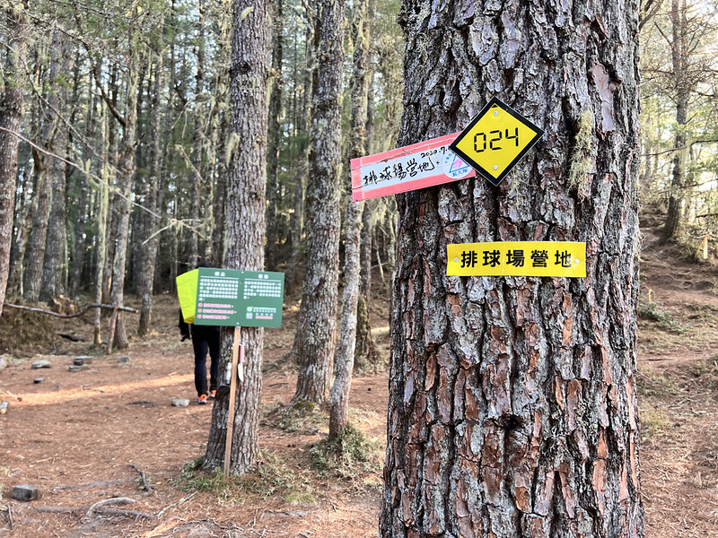
08:05 We reached the 024 mark. This place is called Volleyball Court Campsite
排球場營地. I don't know who gave those names, but those places are beautiful and spacious. You can pitch your tent
here, but you must carry water from the Xinwulu Creek.
You will find phone receptions here. It was strong enough for me to text but still patchy to send images.
08:37 We passed the 025 mark, which is the Soccer Court Campsite 足球場營地. We
took a long break and started playing fake soccer games.
09:54 We arrived at the 027 mark, which is the Golf Court Campsite 高爾夫球場.
Without a doubt, it was time to swine a golf club.
As we enjoyed our lunch, wisps of mist danced around us, weaving in and out like ethereal spirits. The scene
before us transformed, wrapped in mystery and reminiscent of a land from fairy tales.
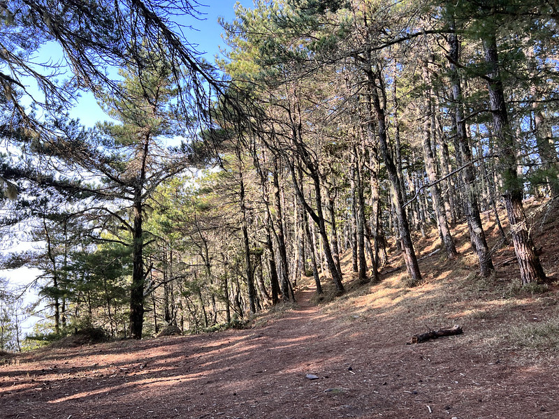
For us Taiwanese, such Coniferous Forests are a rare delight, stirring our excitement. The thought of tents
pitched atop soft pine needles was tempting to make another visit.
Yet, the trail ahead called. We bid farewell to this enchanting woodland and continued the trek.
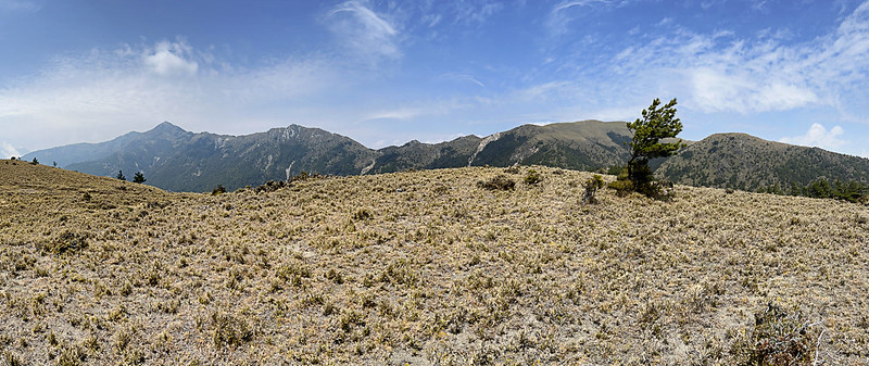
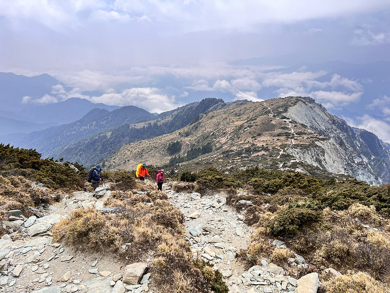
12:08 The forests were gradually replaced by grassland and the view opened up.
When we did this hike in March 2023, southern Taiwan and several high mountains suffered droughts. The grass
looked scorched under the brutal sun.
Whispers of the Formosan Sambar and Surprises Under a Star-Spangled Sky
12:22 We passed the Jiaming Lake Sister Pond, and we were not surprised to see
the pond was left with a dry bed.
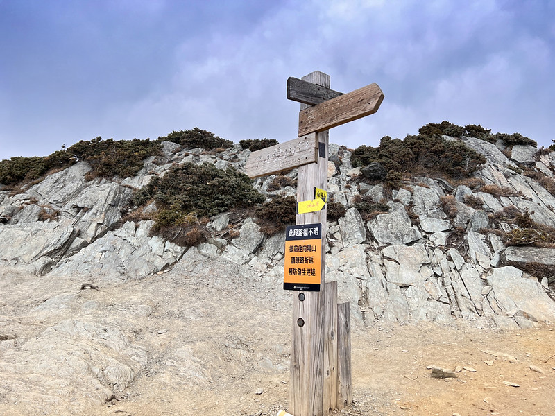
12:30 I passed the sign pointing to the Hunter Campsite, and we started
descending.
12:53 Finally, we reached the Hunter Campsite.
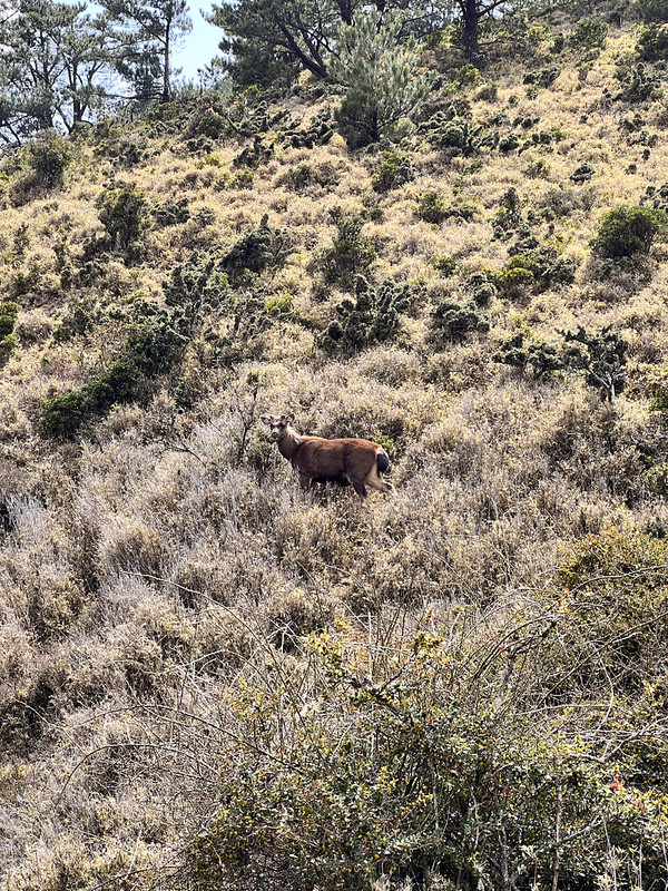
As we prepared to gather water, the silhouette of a Formosan Sambar Deer emerged near our tents, a delight
encounter with such a majestic creature. Our guides told us about their frequent nocturnal visits. Later, the
glow of various eyes watched as I ventured into the shadows.
The charm of the Jiemaosi Route to Jiaming Lake has drawn many, but not all honor the Leave No Trace and
sanctity of nature. So, remember to draw your water from a distance and respect the land.
Surprisingly, our phones could receive a signal to the outside world. With time on our side, our guide, Xiao
Tsai, showcased an alternative therapy using his machete. Our Ukrainian hiking mates stood unflinching, while
I almost embarrassed myself.
As dusk fell and our bellies filled, we retreated to our shelter. Yet, the starry sky was too bright to
ignore. Ben, Rose, and I moved our sleeping pads and lay under the stars. As if on cue, a meteor streaked the
heavens, and we all witnessed it together — a shared spectacle forever etched in my memories.
Day 3: Dawn's Embrace Over Jiaming Lake
I did the traditional route to Jiaming Lake in October 2023. However, due to the lack of experience, I missed
the gorgeous sunrise even though the weather was great that morning. But this day, I bore hope in every step,
eager for a second chance.
03:00 We got up, had breakfast and packed our gear.
04:00 Set out to Jiaming Lake.
What awaited was a 400-meter ascent awaited, and my heart fluttered with anxiety and excitement (or just lack
of enough training). The soft light rising from the eastern horizon made me uneasy even more.
05:33 At last, Jiaming Lake was unveiled before us. While we raced to the
perfect point, the universe painted my long-awaited sunrise - a dance of hues and reflections.
I ventured to the lake's edge during my first journey. I stayed put this time, trying to capture its magic in
a timelapse.
Timelapse of Jiaming Lake #Taiwan #lake #mountains #sunrise pic.twitter.com/NSs4pRXlWY
— Anusha - Taiwan Mountains (@AnushaHiking) March 22, 2023
Ben, with a burst of energy, circled the lake thrice, and we watched in awe.
06:44 With a reluctant heart, it was time to leave. Gusts of wind were also
picking up. For the details of this section back to Siangyang Forest Recreation Area, you can read my previous Jiaming Lake
post.
We reached Mt. Sancha. The wind was so strong that we could barely stay put.
The ever-changing landscape revealed hidden treasures, like a different face of the Jiaming Lake Cabin, bathed
in clarity compared to my cloudy recollection from the previous journey.
09:10 The Jiaming Lake Cabin welcomed us, and we took a one-hour break.
While marching away from the cabin, I noticed this massive boulder escaped my attention during my first hike.
When reaching the junction to Mt. Siangyang, I chose to bypass due to the moody skies. Plus, I was already
exhausted.
11:20 We passed the Siangyang Famous Tree.
12:14 We passed Siangyang Cabin.
14:04 The familiar Siangyang Checkpoint marked the day's end.
In the interlude, as we awaited our fellow hiking mates, Mother Nature once again played on fog and sunrays in
a mischievous dance of hide and seek at Siangyang Forest Recreation Area.
A fitting, dreamy curtain closed our hiking story to the Angel's Tear Drop, Jiaming Lake.
The Story of Jiemaosi: History, Significance, and What to Expect
In the Bunun tribal language 布農族, "Jiemaosi" (Kaimusu/Kaimos) refers to a type of spice plant. Its fruit emits
a fragrance reminiscent of pepper, making it a choice of seasoning.
At the same time, "Jiemaosi" is also the name of one of the Bunun tribal communities, located approximately
1,700 meters above sea level on the banks of the Xinwulu Creek 新武呂溪, to the southwest of Bulaksan Mountain
布拉克桑山, close to today's South Cross-Island Highway near Liyuan 栗園.
Although Jiemaosi was never a large community, by 1934, it had dwindled to only two households due to
resettlement policies and ultimately ceased to exist. However, before the uprising in 1915, the Jiemaosi tribe
members made their mark by resisting Japanese rule.
In a significant act of defiance, they successfully assassinated a Japanese police officer at the Batongguan post 八通關古道. This
act sounded the first shot of the fierce Bunun resistance against Japanese rule.
The trail from Jiemaosi to Jiaming Lake was originally a hunting path for the Bunun tribe. After they migrated
from Nantou to the Dafen Mountain 大分山 and Lakulak River 拉庫拉溪 in Hualien, some members crossed Jiemaosi,
following this route to the Xinwulu Creek in Taitung in search of a new homeland.
Furthermore, this path wasn't just for migration and hunting — it was also a crucial route for the Bunun tribe
to establish marital alliances with other communities, underscoring its importance in migration, hunting, and
marriage proposals.
Fast forward to today, this ancient hunting trail has transformed into a paradise for mountain enthusiasts.
Since 2005, when the government started to regulate the number of visitors on the traditional route, this old
hunter's path became a popular alternative.
Now, due to its easy application process and pristine scenery, it has becomeg the most sought-after path to
Jiaming Lake.
Sources: Hiking Biji and Chase Together.

