Best Permit-Free Hiking Trails in Taiwan (2026) — Easy Access to Public Transport in Every County and City

Planning a permit-free hike by bus?
Skip the research. This guide covers 41 relaxing, permit-free trails in every Taiwan county — with trailhead maps and the exact public transport to reach each one. Everything you need to just show up and hike.
Get all 41 trails + maps →Table of Contents:
- 📌 Latest Trail Closure Information
- Trails in Northern Taiwan: Taipei, Keelung, Taoyuan, Hsinchu, and Miaoli
- Trails in Central Taiwan: Taichung, Changhua, Nantou, Yunlin, and Chiayi, Including a Zhuilu Alternative in Nantou
- Trails in Southern Taiwan: Chiayi, Tainan, Kaohsiung, and Pingtung
- Trails in Eastern Taiwan: Yilan, Hualien, and Taitung
- Bonus: Taiwan's Best High Mountain Trails with Must-Have Checklists
📌 Latest Trail Closure Information
- Tashan and Mianyue Line in Alishan: from July 1, 2026, to the end of June 2027.
- St. Maria Trail: the road to the trailhead is under construction from June 10, 2026, to November 10, 2026.
- Sanxiantai Bridge and Trail: the trail on the Island and the bridge are closed for renovation from May 2026 to the end of 2027. But the recreation area is still open.
- 5 trails at Dakeng are still closed: No. 1, No. 3, No. 5, No. 10, and No. 11 as of this post.
Trails in Northern Taiwan: Taipei, Keelung, Taoyuan, Hsinchu, and Miaoli
Taipei and Keelung
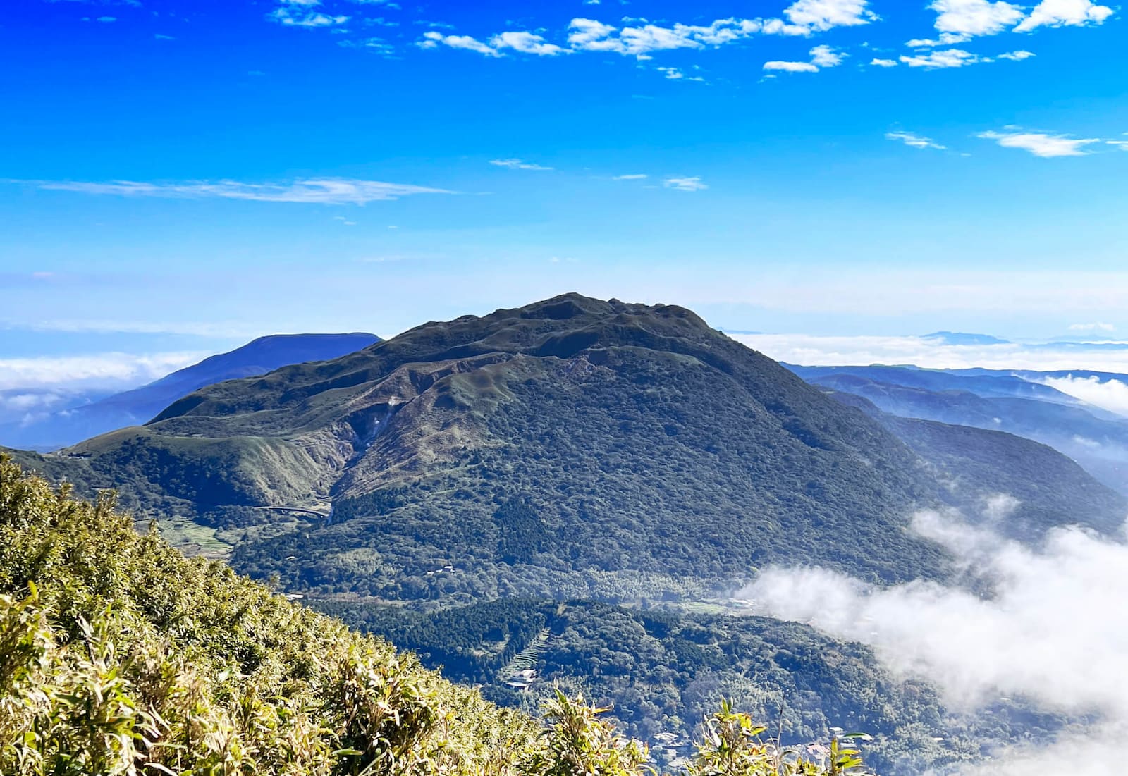
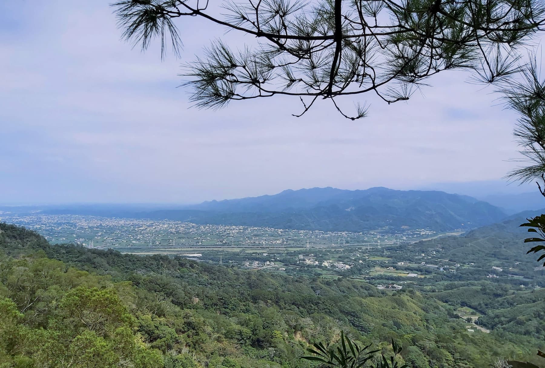
Mt. Qixing and Xiaoyoukeng 七星山, 小油坑
- Difficulty level: 2/5
- Duration: 3-5 hours
- Distance: 4 km
- Public Transport: Take Bus 108. See the Mt. Qixing guide.
- Note: Mt. Qixing is listed as Minor 100 Peaks.
Mt. Datun Main, West, and South Peaks大屯山主峰, 西峰, 南峰
- Difficulty level: 3/5
- Duration: 4-6 hours
- Distance: 5.8 km
- Public Transport: Take Bus S6. See the Mt. Datun guide.
- Note: Mt. Datun is listed as Minor 100 Peaks.
Teapot Mountain 茶壺山
- Difficulty level: 2/5
- Duration: 3-5 hours
- Distance: 6.6 km
- Public Transport: Take Bus 1062. See the Teapot Mountain guide.
Keelung Islet and Heping Island Trail 基隆嶼, 和平島
- Difficulty level: 2/5
- Duration: one day
- Public Transport: See the Keelung Islet Lighthouse and Heping Island guide.
- Note: Keelung Islet is open for application between April 1 and October 31, 2025.
Taoyuan
Mt. Dongyang (Dongyangshan) Forest Recreation Area 東眼山國家森林遊樂區
- Difficulty level: 1/5
- Duration: 3-5 hours
- Distance: Total 8 km
- Public Transport: Take Dongyanshan Route (506) and get off at Dongyanshan Forest Recreation Area.
- Note: Mt. Dongyang is listed as Minor 100 Peaks.

Sanmin Bat Cave 三民蝙蝠洞
- Difficulty level: 1/5
- Duration: 5-6 hours
- Distance: 6.2 km
- Public Transport: Take Bus F906 or 5107 to Bat Cave (Bat Hole) Stop. F906 also goes to Dongyanshan.
- Note: The trail is very slippery.
Hsinchu
Mt. Feifong, Mt. Zhongkeng, and Guanriping Trail 飛鳳山, 中坑山, 觀日坪古道
- Difficulty level: 2/5
- Duration: 3-4 hours
- Distance: 6 km
- Public Transport: Take Kuokuang Bus 1820 get off at Qionglin 芎林 stop.
- Note: Some hikers list Mt. Feifong or Mt. Zhongkeng as Minor 100 Peaks.
Miaoli
San-Yuan Hike (From Sanyi to Tongluo) 三員縱走
- Difficulty level: 2/5
- Duration: 5-6 hours
- Distance: 12 km
- Public Transport: The trailhead on the Sanyi side is very close to Sanyi Train Station. See the Sanyi Tongluo Hike.
- Note: This is a ridgeline hike and is famous for Tong Tree blossoms.
Mt. Huoyan 火燄山
- Difficulty level: 2/5
- Duration: 3-4 hours
- Distance: 6.4 km
- Public Transport: Take Miaoli Bus 5818 from Yuanli Train Station 苑裡火車站 and get off at Bogongken Stop 伯公坑站.
- Note: The sections near the cliffs are fragile and prone to collapse. Several hikers have fell to their deaths. Stay on the designated trails.

Planning a permit-free hike by bus?
Skip the research. This guide covers 41 relaxing, permit-free trails in every Taiwan county — with trailhead maps and the exact public transport to reach each one. Everything you need to just show up and hike.
Get all 41 trails + maps →Trails in Central Taiwan: Taichung, Changhua, Nantou, Yunlin, and Chiayi
Taichung
Dakeng Trails (12 Trails) 大坑步道
- Difficulty level: 2/5
- Duration: 2-5 hours
- Distance: 2-5 km
- Public Transport: Take Bus 66V Dakeng Route Line (Right Loop and Left Loop) 66副大坑線 (左環, 右環) from Songzhu Railway Station 松竹車站 and get off at No. 3 Hiking Trail Stop, Trail No. 2 Hiking Trail Stop, or No. 1 Hiking Trailhead. Or take SF Ebus 922 from Taichung MRT Songzhu Station and get off at Dakeng No 9.
- Note: You can do Dakeng Trail No. 1, No. 2, No. 3, No. 3-1, No. 4, and No. 5 together. You can reach Taichung's highest mountain, Mt. Touke 頭嵙山, also listed as Minor 100 Peaks. Or group Trail No. 6, No. 7, No. 8, No. 9, No. 9-1, and No. 10 together.
- Taichung's 24-Hour Toll-Free Travel Information Hotline: 0800-011765
Changhua
Qingshuiyan Trails 清水岩步道群
- Difficulty level: 2/5
- Duration: 2-3 hours
- Distance: 4.1 km
- Public Transport: Take Bus 6915 or 6915A from Yunlin Train Station, and get off at the Qingshuiyan stop 清水岩. Walk around 10 minutes from the bus stop to the Qingshuiyan entrance.
Yunlin
Jiananyun Peak Trail 嘉南雲峰步道
- Difficulty level: 3/5
- Duration: 4-5 hours
- Distance: 4.3km
- Public Transport: Take Bus 701 and get off at the last stop, Dongbi Villa 東碧山莊. Walk 2 km to the trailhead.
Nantou
Mt. Maolan 貓囒山 in Sun Moon Lake
- Difficulty level: 1/5
- Duration: 2 hours
- Distance: 5.4 km
- Public Transport: Take bus 6670D from HSR Taichung Station and get off at the Sun Moon Lake Stop. The trailhead is close to Shuishe Pier (Shuishe Port) 水社碼頭. The trailhead is at Lane 270, Zhongshan Road, Yuchi Township.

Lie Ren Trail, aka Hunters Trail 獵人古道 in Wangxiang Village 望鄉部落
- Difficulty level: 2/5
- Duration: 5 hours
- Distance: 11 km
- Public Transport: Take bus 6739 and get off at Huo-she stop. Walk around 1.7km (1 mile) to Lie Ren Trail's trailhead. Or you can stay at a B&B in Wangxiang Village and enjoy the indigenous culture.
- Note: Wangxiang Village is a beautiful Bunun village and is surrounded by mountains. You can read details about Lie Ren Trail.
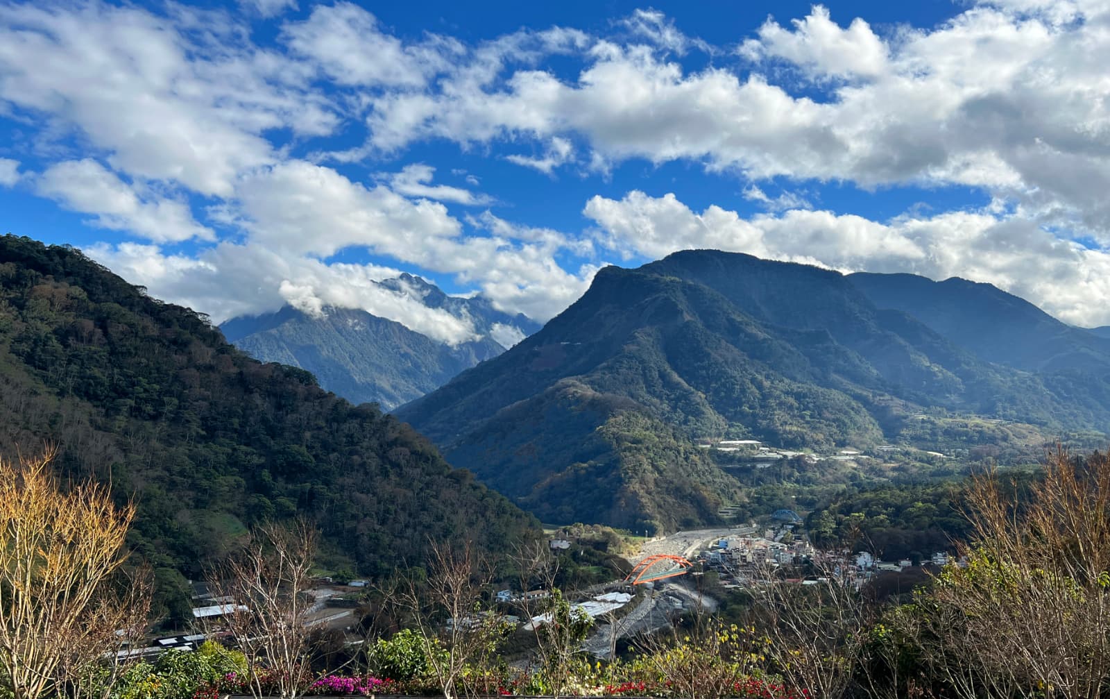
Yunlong Waterfall Trail in Dongpu 東埔雲龍瀑布步道
- Difficulty level: 2/5
- Duration: 4-5 hours
- Distance: 9 km
- Public Transport: Take bus 6732 or 6734 from Shuili Station or from Huo-she Stop. Take bus 6333D from HSR Taichung Station to Shuili Stop.
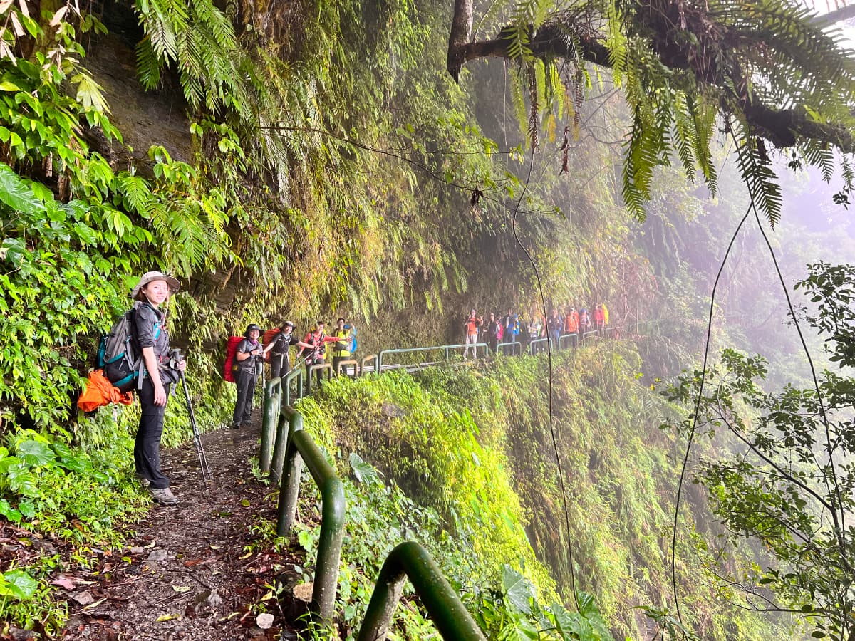
- Note: I was blown away by the sweeping valley and mountain views on this section of the Batongguan Traversing Trail. The permit-free hike to Yunlong Waterfall offers dramatic scenery and feels like a rare find. It strongly resembles the Zhuilu Historic Trail, which was sadly damaged by the earthquakes on April 3, 2024. Watch for rockfall and landslides near the 3.3 km mark—turn back if needed; the views alone are worth it.

Planning a permit-free hike by bus?
Skip the research. This guide covers 41 relaxing, permit-free trails in every Taiwan county — with trailhead maps and the exact public transport to reach each one. Everything you need to just show up and hike.
Get all 41 trails + maps →Trails in Southern Taiwan: Chiayi, Tainan, Kaohsiung, and Pingtung
Chiayi
Taiping Suspension Bridge and Cloud South Trail 太平雲梯, 雲之南道
- Difficulty level: 1/5
- Duration: 2-4 hours
- Distance: 1.5 km
- Public Transport: Take Bus 7315 or 7315A from Chiayi or Dalin Train Stationand get off at the Taiping stop.
Tainan
Mt. Dadong in Guanziling (Guanzihling) 關仔嶺大凍山 雞籠山
- Difficulty level: 2/5
- Duration: 4-5 hours
- Distance: 6 km
- Public Transport: Take Guanziling Route (33) and get off at Quanzihling Stop 嶺頂旅遊資訊站.
- Note: Mt. Dadong in Guanziling is the highest mountain in Tainan and is also listed as Minor 100 Peaks.
Kaohsiung
Shoushan (Chaishan) Hiking Trails 壽山 (柴山)步道
- Difficulty level: 2/5
- Duration: It depends on how long you want to go.
- Distance: The trails vary.
- Public Transport: Take Kaohsiung Light Rail and get off at Wenwu Temple Stop 文武聖殿站, and walk to the trailhead. Or take Taiwan Tourist Shuttle Bus 56 A, B or C, and get off at Shoushan Zoo.
- Note: There are military bases in Shoushan, and visitors are not allowed to enter. There will be hefty fines or even being prosecuted.

Mt. Qiwei to Lingshan from Qishan to Meinong 旗尾縱走 (旗山-美濃)
- Difficulty level: 2/5
- Duration: 4-5 hours
- Distance: 10.4 km
- Public Transport: See the Qiwei and Lingshan guide.
- Note: Mt. Qiwei is listed as Minor 100 Peaks.
Pingtung
Mt. Dashanmu (Dashanmushan) 大山母山
- Difficulty level: 2/5
- Duration: 2-3 hours
- Distance: 4.8 km
- Public Transport: Take Kuoguang Bus 9117 or 9188 and get off at Tiaoshizi Stop 跳石仔. Then walk around 1 km to the trailhead.
- Note: Mt. Dashanmu is listed as Minor 100 Peaks.

Planning a permit-free hike by bus?
Skip the research. This guide covers 41 relaxing, permit-free trails in every Taiwan county — with trailhead maps and the exact public transport to reach each one. Everything you need to just show up and hike.
Get all 41 trails + maps →Trails in Eastern Taiwan: Yilan, Hualien, and Taitung
Yilan
Taipingshan 太平山, Cuifeng Lake 翠峰湖, and Jancing Historical Trail 見晴古道
- Difficulty level: 1/5
- Public Transport: Take Kuokuang Bus 1750 on the weekends, and 1750A on the weekdays. See the Jancing Trail guide.
- Note: Mt. is listed as Minor 100 Peaks.
Hualien
Chihnan National Forest Recreation Area 池南國家森林遊樂區, Mt. Liyu (Carp) 鯉魚山, and Liyu Lake Trail 鯉魚潭
- Difficulty level: 1/5
- Duration: You can put Chihnan, Mt. Liyu, and Liyu Lake together in one hike.
- Public Transport: Take Bus 1139 from Hualien Bus Station and get off at Chinan (Chihnan) Stop or Liyutan (Liyu Lake) Stop.

Walami Trail 瓦拉米步道
- Difficulty level: 2/5
- Duration: 4-5 hours, plus the walk to the trailhead and back
- Distance: 27.2 km
- Public Transport: No. The closest station is Yuli Train Station. Then, call a taxi to the trailhead. See the Walami Trail guide.
- Note: If you plan to stay at Walami overnight or hike pass Jiaxi, you need to apply for a permit.
Taitung
Dulanshan Trail 都蘭山步道
- Difficulty level: 2/5
- Duration: 4-6 hours
- Distance: 7.6 km
- Public Transport: No. You walk 4.2 km uphill from the bus stop Nanjunjie 南郡界 to Dulanshan trailhead.
Mt. Balangwei 巴塱衛山
- Difficulty level: 2/5
- Duration: 1.5 hours
- Distance: 4.6 km
- Public Transport: Take Bus 8135 or 8136 from Taitung, and get off at Beilong Temple. Walk 2.3 km from the bus stop. Mt. Balangwei is next to the trailhead.
- Note: Mt. Balangwei is listed as Minor 100 Peaks.

Planning a permit-free hike by bus?
Skip the research. This guide covers 41 relaxing, permit-free trails in every Taiwan county — with trailhead maps and the exact public transport to reach each one. Everything you need to just show up and hike.
Get all 41 trails + maps →