The List of Taiwan's 100 High Mountains and How to Complete 100 Peaks
Taiwan's total land area is 36,197 km² (13,976 miles²), slightly larger than Belgium and the U.S.
state of Maryland (Note 1). 70% of the country is covered by mountains and hills. Yet, there are 268 mountains
(Note 2) over 3,000 meters of elevation, while there are no mountains over 3,000 meters above sea level in
Australia and 403 peaks in greater North America (Note 3).
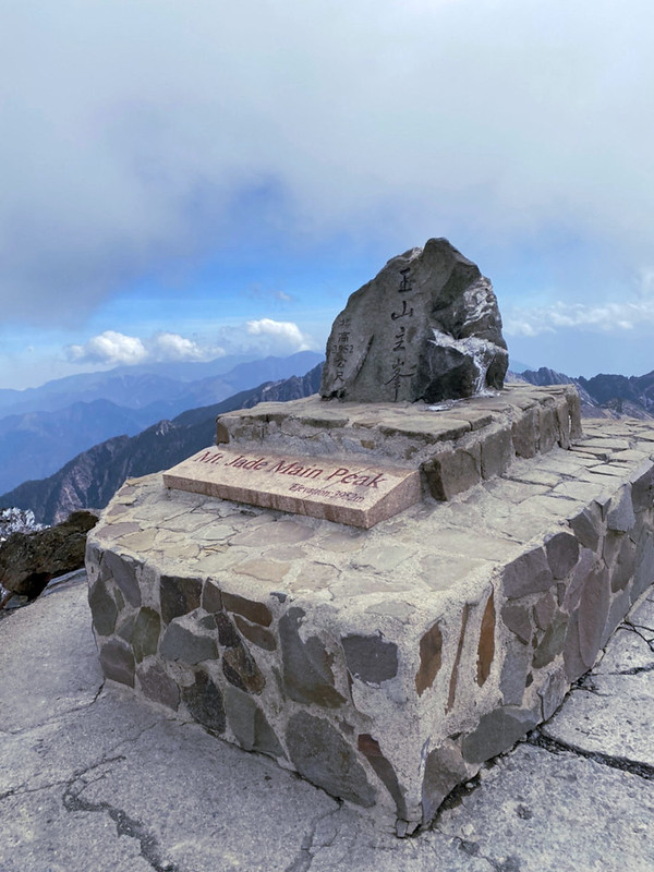
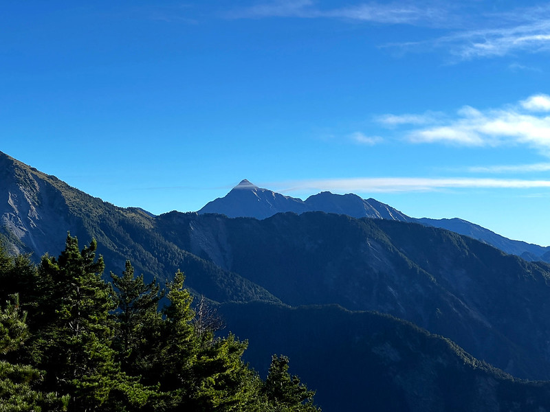
The highest mountain in Taiwan is Yushan, aka Jade Mountain, 3,952 meters above sea level.
You can find the list in English on the internet, but not many discuss how to group those high mountains, the
routes, the difficulty level, etc., in English. I will introduce the 100 Peaks, the difficulty level, the
number of hiking days, and the routes if you plan to bag all the peaks.
You will also find links to the blog posts about those routes I wrote.
Disclaimer:
All content is for inspiration only. Use Taiwan Hikes' suggestions at your own risk. We are not responsible for any losses, injuries, or damages.
Taiwan Hikes may include affiliate links. When you purchase through these links, you support our ability to continue providing FREE content — at no additional cost to you.
Notes:
Note 1: How Big is Taiwan Compared to Other Countries/ States?
Note 2: There are several versions of the number of high mountains over 3,000 meters: 258, 268, 275, and even 285 listed on Wikipedia. This post mainly focuses on the listed 100 Peaks in Taiwan.
Note 3: List of the highest major summits of North America
Disclaimer:
All content is for inspiration only. Use Taiwan Hikes' suggestions at your own risk. We are not responsible for any losses, injuries, or damages.
Taiwan Hikes may include affiliate links. When you purchase through these links, you support our ability to continue providing FREE content — at no additional cost to you.
All content is for inspiration only. Use Taiwan Hikes' suggestions at your own risk. We are not responsible for any losses, injuries, or damages.
Taiwan Hikes may include affiliate links. When you purchase through these links, you support our ability to continue providing FREE content — at no additional cost to you.
Table of Contents:
- Taiwan's 100 Peaks (Baiyue 百岳) and Why Hiking High Mountains in Taiwan
- Complete List of Taiwan's 100 Peaks: Routes in Yushan National Park
- Complete List of Taiwan's 100 Peaks: Routes in Shei-pa National Park
- Complete List of Taiwan's 100 Peaks: Routes in Taroko National Park
- Complete List of Taiwan's 100 Peaks: Routes Outside of National Parks
- Furthermore, Information about Hiking All 258+ of the High Mountains in Taiwan
- Free Guides: How to Apply for Hiking Permits in Taiwan. Or Hire Me!
Exploring Taiwan? Save Time with the Ultimate 2025 Hiking Guide! Discover the top hikes in every city and
county across Taiwan—all accessible by public transport (bus links available). We've spent 50+ hours
researching the best trails and transit options, so you can skip the hassle and start your adventure!
Taiwan's 100 Peaks (Baiyue 百岳) and Why Hiking High Mountains in Taiwan
Disclaimer: These hiking routes are provided for free. We are not responsible for any mistakes,
injuries, or issues that may arise from using these routes. Hike safely and at your own risk.
Why Hike High Mountains in Taiwan?
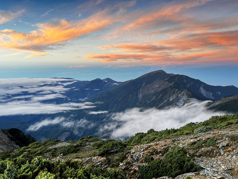
Despite being a small tropical island, Taiwan boasts a remarkable range of climates—from tropical to
subtropical to temperate—as you ascend its peaks. These high mountain hikes reward you with stunning scenery
and a rich diversity of flora and fauna, making every trek a unique and unforgettable adventure.
The popular 100 Peaks trails are well-maintained, and the views are spectacular. These trails are excellent
for people looking for challenges and unique landscapes.
Brief Introduction of Taiwan's 100 Peaks
Inspired by the book 100 Famous Mountains in Japan 日本百名山, written by Kyuya Fukada 深田久彌, the Taiwanese
mountaineer Mt. Wenan Lin 林文安 was the first person who selected
100 mountains based on the following criteria:
- Mountains over 10,000 feet,
- Marked names on the map,
- Triangulation stones can be found on the summits.
After multiple explorations and consultations with experienced mountaineers, the list was finalized. Mt. Lin,
3 other important mountaineers during that time, Jingzhang Tsai 蔡景璋, Tianzheng Xing, 刑天正, Tongsan Ding 丁同三,
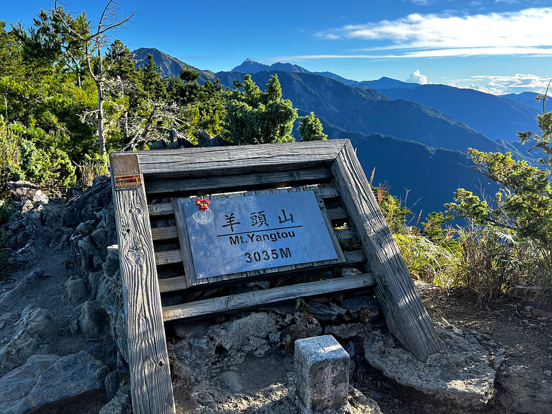
and other hikers established 100 Peaks Club (Baiyue Club) 百岳俱樂部and celebrated its establishment at Mt. Yangtou
on December 5, 1972.
Since then, bagging 100 peaks has become many hikers' passion and lifetime achievement.
The following routes are based on the prestigious map company, Sun River, and the permit application website from national parks in
Taiwan. Sun River went out of business for good in March 2023, but they still keep the website live to help
hikers explore the high mountains in Taiwan.
The difficulty levels are referenced on the Yushan, Shei-Pa, and Taroko National Park websites. Some high
mountains, such as Mt. Beidawu, are not located in any national park, and I found the difficulty rating from
Hiking
Note 健行筆記, the primary hiking resource in Taiwan.
Please note that there are different routes to hike the thru hikes mentioned in the list. If you are
unsatisfied with those routes, please do your homework.
Generally speaking, if you plan to complete all of Taiwan's 100 Peaks, the least number of hikes to do is 25.
You will hike some peaks twice. If you are an ultra-runner, it's a different story and beyond the scope of
this post.
How Many People Have Completed the 100 Peaks?
I can't find the statistics about how many people have finished all the mountains. It is said that fewer than
1,000 people have bagged the 100 Peaks, and around 20 of them are foreigners.
To get some ideas about completing Taiwan's 100 Peaks, watch this video by Richard's Asia Hikepedia, The Fastest Foreigner to Complete Taiwan's 100 Peaks!
The difficulty rating system is from the Yushan National Park, with 1 being the easiest and
6 being the most difficult. I also put a screenshot here.
Complete List of Taiwan's 100 Peaks: Routes in Yushan National Park
1. Yushan (Jade Mountain) Peaks 玉山群峰縱走
Distance: 61.2 km (38 miles)
Days Needed: 6 Days (if you do all the peaks in one go.)
Permits: Park Permit and Police Permit
Difficulty Level: 4 out of 6 (If you only hike Yushan Main Peak, it's 3 out of 6.)
Days Needed: 6 Days (if you do all the peaks in one go.)
Permits: Park Permit and Police Permit
Difficulty Level: 4 out of 6 (If you only hike Yushan Main Peak, it's 3 out of 6.)
Peaks to Reach: 9
- Yushan Main Peak 玉山主峰, 3,952 meters (Can be done alone.) Jade Mountain is also the highest mountain in Taiwan.
- Yushan East Peak 玉山東峰, 3,874 meters
- Yushan North Peak 玉山北峰, 3,858 meters (Can be done with Yushan.)
- Yushan West Peak 玉山西峰, 3,512 meters (Can be done with Yushan.)
- Yushan Front Peak 玉山前峰, 3,233 meters (Can be done alone or with Yushan.)
- Yushan South Peak 玉山南峰, 3,852 meters
- Lushan or Mt. Lu 鹿山, 2,981 meters
- Mt. Dongxiaonan 東小南山, 3,709 meters
- Nanyushan or Mt. Nanyu or Mt. South Yushan 南玉山, 3,379 meters
Additional Information:
- Usually, this trail is divided by Yushan Front Five 玉山前五 (Yushan Main, East, North, West, and Front Peak) and Yushan Rear 4 玉山後四 (Yushan South Peak, Lushan, Mt. Dongxiaonan, and Mt. Nanyushan).
- Yushan Front Five: 3 days
- Yushan Rear Four: 4 days
- Yushan Rear Four is more challenging than the Front Five.
2. Mt. Jyunda 郡大山 (Post)
Distance: 7.4 km (4.6 miles)
Days Needed: 1 Day
Permits: Police Permit
Difficulty Level: 3 out of 6
Days Needed: 1 Day
Permits: Police Permit
Difficulty Level: 3 out of 6
Peaks to Reach: 1
- Mt. Jyunda 郡大山, 3,278 meters
3. Mt. Xilun 西巒大山
Distance: 14.8 km (9.2 miles)
Days Needed: 1 Day
Permits: Police Permit
Difficulty Level: 3 out of 6
Days Needed: 1 Day
Permits: Police Permit
Difficulty Level: 3 out of 6
Peaks to Reach: 1
- Mt. Xilun 西巒大山, 3,085 meters
4. South Section 3 of the Central Mountain Range Trail (Danda Dongjyun Thru-hike) Thru-hike 南三段縱走 (丹大‧東郡橫斷縱走)
Distance: 104 km (64.6 miles)
Days Needed: 10 Days
Permits: Police Permit and Forestry Agency Permit
Difficulty Level: 6 out of 6
Days Needed: 10 Days
Permits: Police Permit and Forestry Agency Permit
Difficulty Level: 6 out of 6
Peaks to Reach: 6
- Mt. Dongluan 東巒大山, 3,479 meters
- Mt. Dongjyun 東郡大山, 3,617 meters
- Mt. Wushuang 無雙山, 3,243 meters
- Mt. Yixiqingmazhi 義西請馬至山, 3,252 meters
- Mt. Neilinger 內嶺爾山, 3,275 meters
- Mt. Danda 丹大山, 3,329 meters
5. Mabolasi Crossing Trail (Thru-hike) 馬博拉斯橫斷縱走
Distance: 94 km (58.4 miles)
Days Needed: 8 Days
Permits: Park Permit and Police Permit
Difficulty Level: 5 out of 6
Days Needed: 8 Days
Permits: Park Permit and Police Permit
Difficulty Level: 5 out of 6
Peaks to Reach: 7
- Mt. Batongguan 八通關山, 3,335 meters
- Mt. Xiuguluan 秀姑巒山, 3829 meters
- Mt. Mabolasi or Mt. Mabolasih 馬博拉斯山, 3,776 meters
- Mt. Jyupen 駒盆山, 3,030 meters
- Mt. Malijianan 馬利加南山, 3,561 meters
- Mt. Masi 馬西山, 3,443 meters
- Mt. Kasipanan 喀西帕南山, 3,278 meters
6. South Section 2 of the Central Mountain Range 南二段縱走
Distance: 89.3 km (55.5 miles)
Days Needed: 7 Days
Permits: Park Permit, Police Permit, Forestry Agency Permit (If staying at the Jiaming Lake Cabin or Siangyang Cabin)
Difficulty Level: 5 out of 6
Days Needed: 7 Days
Permits: Park Permit, Police Permit, Forestry Agency Permit (If staying at the Jiaming Lake Cabin or Siangyang Cabin)
Difficulty Level: 5 out of 6
Peaks to Reach: 11
- Mt. Xiuguluan or Mt. Siouguluan 秀姑巒山, 3,829 meters
- Mt. Dashuiku or Mt. Dashueiku 大水窟山, 3,643 meters
- Mt. Batongguan 八通關山, 3,335 meters
- Mt. Dafenjian 達芬尖山, 3,206 meters
- Mt. Tafen 塔芬山, 3,070 meters
- Mt. Lulu 轆轆山, 3,278 meters
- Yufeng (Yuan Peak) 雲峰, 3,562 meters
- Mt. Nanshuangtou 南雙頭山, 3,359 meters
- Mt. Guanshanling 關山嶺山, 3,176 meters
- Mt. Sancha 三叉山, 3,496 meters
- Mt. Siangyang 向陽山, 3,603 meters
Additional Information:
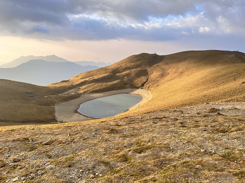
- Mt. Siangyang, Mt. Sancha, and Jiaming Lakecan be a standalone hike.
- Mt. Guanshanling can be a standalone hike.
7. Xinkang Crossing Trail (Thru-hike) 新康橫斷縱走
Distance: 77.6 km (48.2 miles)
Days Needed: 6 Days
Permits: Park Permit and Police Permit
Difficulty Level: 5 out of 6
Days Needed: 6 Days
Permits: Park Permit and Police Permit
Difficulty Level: 5 out of 6
Peaks to Reach: 2
- Mt. Xinkang 新康山, 3,338 meters
- Mt. Bulakesang 布拉克桑山, 3,021 meters
8. South Section 1 of the Central Mountain Range (Thru-hike) 南一段縱走
Distance: 53 km (32.9 miles)
Days Needed: 6 Days
Permits: Park Permit and Police Permit
Difficulty Level: 3 out of 6
Days Needed: 6 Days
Permits: Park Permit and Police Permit
Difficulty Level: 3 out of 6
Peaks to Reach: 6
- Mt. Taguan 塔關山, 3,222 meters
- Mt. Kuhanuoxin 庫哈諾辛山, 3,114 meters
- Mt. Guan or Guanshan 關山, 3,668 meters
- Mt. Hainuonan 海諾南山, 3,173 meters
- Xiaoguanshan or Mt. Xiaoguan 小關山, 3,249 meters
- Mt. Beinan Main or Beinanzhushan 卑南主山, 3,292 meters
Additional Information:
- Mt. Kuhanuoxin and Guanshan can be a standalone hike.
- Both Mt. Kuhanuoxin and Mt. Taguan can be standalone hikes.
- Mt. Guanshanling, Mt. Kuhanuoxin, and Mt. Taguan are also called Southern Cross-island Highway 3 Stars.
Complete List of Taiwan's 100 Peaks: Routes in Shei-pa National Park
1. Holy Ridge Y Route 聖稜 Y 型縱走 (Thru-hike) (Post)
Distance: km ( miles)
Days Needed: hours
Permits: Park Permit
Difficulty Level: 5 out of 6
Days Needed: hours
Permits: Park Permit
Difficulty Level: 5 out of 6
Peaks to Reach: 11
- Mt. Dabajian 大霸尖山, 3,490 meters
- Mt. Xiaobajian 小霸尖山, 3,419 meters
- Mt. Yizhe 伊澤山, 3,296 meters
- Mt. Jiali 加利山, 3,112 meters
- Mt. Tao or Taoshan 桃山, 3,323 meters
- Mt. Kalahei 喀拉業山, 3,132 meters
- Mt. Chiyou 池有山, 3,300 meters
- Mt. Pintian 品田山, 3,528 meters
- Mt. Syue or Xueshan Main Peak 雪山主峰, 3,886 meters. Xueshan is the second-highest peak in Taiwan.
- Xueshan East Peak 雪山東峰, 3,199 meters
- Xueshan North Peak 雪山北峰, 3,703 meters
Additional Information:
- Mt. Dabajian, Mt. Xiaobajian, Mt. Yizhe, and Mt. Jiali can be a standalone hike.
- Taoshan, Mt. Kalahei, Mt. Chiyou, and Mt. Pintian are also called the Wuling Quadruple Mountains Trail.
- Taoshan can be done in a day.
- You can hike just Taoshan or Mt. Chiyou or put two of those mountains in one go.
- Xueshan East Peak is on the way to Xueshan Main Peak.
2. Xueshan West Ridge (Thru-hike) 雪山西稜線
Distance: 71.8 km (44.6 miles)
Days Needed: 6 Days
Permits: Park Permit
Difficulty Level: 4 out of 6
Days Needed: 6 Days
Permits: Park Permit
Difficulty Level: 4 out of 6
Peaks to Reach: 6 (You will hike Xueshan Main Peak and East Peak again.)
- Mt. Xue (Xueshan) Main Peak 雪山主峰, 3,886 meters
- Xueshan East Peak 雪山東峰, 3,199 meters
- Mt. Zhongxue 中雪山, 3,172 meters
- Mt. Daxue 大雪山, 3,530 meters
- Mt. Touyin 頭鷹山, 3,509 meters
- Mt. Houshi 火石山, 3,309 meters
3. Daxiaojian 大小劍
Distance: 48.6 km (30.2 miles)
Days Needed: 4 Days
Permits: Park Permit
Difficulty Level: 5 out of 6
Days Needed: 4 Days
Permits: Park Permit
Difficulty Level: 5 out of 6
Peaks to Reach: 3
- Mt. Jiayang 佳陽山, 3,314 meters
- Mt. Dajian 大劍山, 3,593 meters
- Mt. Jian or Mt. Xiaojian 劍山 (小劍山), 3,256 meters
Additional Information:
- You can put Daxiaojian, Xueshan Main Peak, and Xueshan East Peak together called Xue-Jian Route 雪劍線. This route will become a 5-day thru-hike, and the difficulty level is 5.
4. Mt. Jijiayang 志佳陽山
Distance: 16.6 km (10 miles)
Days Needed: 1-2 Days
Permits: Park Permit
Difficulty Level: 3 out of 6
Days Needed: 1-2 Days
Permits: Park Permit
Difficulty Level: 3 out of 6
Peaks to Reach: 1
- Mt. Jijiayang 志佳陽山, 3,345 meters.
Additional Information:
- The old trailhead to Xueshan is from Mt. Jijiayang, and hike to Xueshan Main Peak and East Peak. This is a 3-day hike, and the difficulty level is 4.
Complete List of Taiwan's 100 Peaks: Routes in Taroko National Park
1. North Section 1 of the Central Mountain Range Trail (Thru-hike) 北一段縱走
Distance: 80 km (49.7 miles)
Days Needed: 7 Days
Permits: Park Permit and Police Permit
Difficulty Level: 5 out of 6
Days Needed: 7 Days
Permits: Park Permit and Police Permit
Difficulty Level: 5 out of 6
Peaks to Reach: 8
- Mt. Shenmazhen 審馬陣山, 3,140 meters
- Mt. Nanhu North or Nanhu North Mountain 南湖北山, 3,534 meters
- Mt. Nanhu 南湖大山, 3,741 meters
- Mt. Nanhu East Peak 南湖大山東峰, 3,639 meters
- Mt. Mabishan 馬比杉山, 3,211 meters
- Mt. Nanhu South Peak 南湖大山南峰, 3,505 meters
- Mt. Baba 巴巴山, 3,448 meters
- Mt. Zhongyangjian 中央尖山, 3,698 meters
Additional Information:
- Some hikers might exclude Mt. Zhongyangjian and make it a hike to Mt. Nanhu if they don't plan to bag all the 100 Peaks.
2. North Section 2 of the Central Mountain Range Trail (Thru-hike) 北二段縱走
Distance: 50.9 km (31.6 miles)
Days Needed: 5 Days
Permits: Park Permit
Difficulty Level: 5 out of 6
Days Needed: 5 Days
Permits: Park Permit
Difficulty Level: 5 out of 6
Peaks to Reach: 4
- Mt. Shuang or Shuangshan 閂山, 3,168 meters
- Mt. Lingming 鈴鳴山, 3,272 meters
- Mt. Wuming 無明山, 3,449 meters
- Ganshu Peak 甘藷峰, 3,157 meters
Additional Information:
- Shuangshan and Mt. Lingming can be put together, and the difficulty level is 4.
3. Mt. Bilu and Mt. Yangtou Thru-hike 畢羊縱走 (Post)
Distance: 19.4 km (12.1 miles)
Days Needed: 3 Days
Permits: Park Permit
Difficulty Level: 4 out of 6
Days Needed: 3 Days
Permits: Park Permit
Difficulty Level: 4 out of 6
Peaks to Reach: 2
- Mt. Bilu 畢祿山, 3,370 meters: can be a standalone hike.
- Mt. Yangtou 羊頭山, 3,033 meters: can be a standalone hike.
4. Hehuanshan Peaks 合歡群峰
Distance: 0.784 km to 13.4 km. Please see below.
Days Needed: 2 Days if you do them in one go.
Permits: Not Required
Difficulty Level: from 3 to 4 out of 6
Days Needed: 2 Days if you do them in one go.
Permits: Not Required
Difficulty Level: from 3 to 4 out of 6
Peaks to Reach: 5
- Hehuanshan Main Peak 合歡山主峰, 3,417 meters. Distance: 3.6 km (2.2 miles).
- Hehuanshan East Peak 合歡山東峰, 3,419 meters. Distance: 2.1 km (1.3 miles).
- Mt. Shimen 石門山, 3,236 meters. Distance: 0.784 km.
- Hehuanshan North Peak 合歡山北峰, 3,422 meters. Distance: 4 km (2.5 miles).
- Hehuanshan West Peak 合歡山西峰, meters. Distance: 13.4 km (8.3 miles).
Additional Information:
- Those are the easiest high mountain trails to hike in Taiwan.
- If you extend your hike from Hehuanshan North Peak to West Peak, the out-and-back route is 13.4 km, and the difficulty level is 4.
5. Mt. Qilai Main and North Peak 奇萊主北
Distance: 30 km (18.6 miles)
Days Needed: 3 Days
Permits: Park Permit
Difficulty Level: 5 out of 6
Days Needed: 3 Days
Permits: Park Permit
Difficulty Level: 5 out of 6
Peaks to Reach: 2
- Mt. Qilai Main Peak 奇萊主峰, 3,562 meters
- Mt. Qilai North Peak 奇萊北峰, 3,606 meters
6. Mt. Pingfeng 屏風山
Distance: 20 km (12.4 miles)
Days Needed: 3 Days
Permits: Not required, but you must apply for the Pingfeng Shelter if you want to stay there.
Difficulty Level: 4 out of 6
Days Needed: 3 Days
Permits: Not required, but you must apply for the Pingfeng Shelter if you want to stay there.
Difficulty Level: 4 out of 6
Peaks to Reach: 1
- Mt. Pingfeng 屏風山, 3,248 meters
7. Qilai East Ridge 奇萊東稜
Distance: 56 km (34.8 miles)
Days Needed: 6 Days
Permits: Park Permit
Difficulty Level: 5 out of 6
Days Needed: 6 Days
Permits: Park Permit
Difficulty Level: 5 out of 6
Peaks to Reach: 5
- Mt. Qilai North Peak 奇萊北峰, 3,606 meters
- Mt. Panshi 磐石山, 3,105 meters
- Mt. Taroko 太魯閣大山, 3,282 meters
- Mt. Liwujhu立霧主山, 3,071 meters
- Mt. Patuolu 帕托魯山, 3,102 meters
8. Qilai Nanhua (Mt. Qilai South Peak and Mt. Nanhua) 奇萊南華 (Post)
Distance: 37.2 km (23.1 miles)
Days Needed: 2 Days
Permits: Only Mt. Qilai South Peak is located in the Taroko National Park and requires a Park Permit.
Difficulty Level: 3 out of 6
Days Needed: 2 Days
Permits: Only Mt. Qilai South Peak is located in the Taroko National Park and requires a Park Permit.
Difficulty Level: 3 out of 6
Peaks to Reach: 2
- Mt. Qilai South Peak 奇萊山南峰, 3,357 meters
- Mt. Nanhua or Mt. Nenggao North Peak 南華山(又稱能高北峰), 3,182 meters
Additional Information:
- This route has a new trailhead, which increases the difficulty level.
Complete List of Taiwan's 100 Peaks: Routes Outside of National Parks
1. Mt. Baigu 白姑大山 (Post)
Distance: 18 km (11.1 miles)
Days Needed: 2-3 Days
Permits: Not Required
Difficulty Level: 4 out of 6
Days Needed: 2-3 Days
Permits: Not Required
Difficulty Level: 4 out of 6
Peaks to Reach
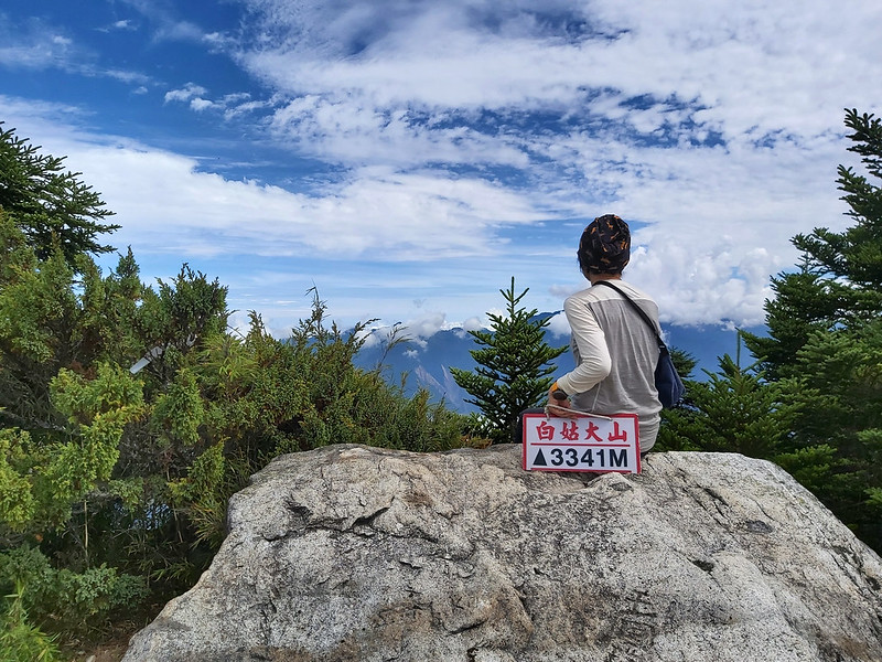
- Mt. Baigu 白姑大山, 3,341 meters
2. North Section 3 of the Central Mountain Range Trail (Neng Gao An Dong Jun) (Thru-hike) 北三段縱走(能高安東軍)
Distance: 49 km (30.4 miles)
Days Needed: 6 Days
Permits: Police Permit
Difficulty Level: 5 out of 6
Days Needed: 6 Days
Permits: Police Permit
Difficulty Level: 5 out of 6
Peaks to Reach: 5
- Mt. Nenggao Main Peak 能高主峰, 3,261 meters
- Mt. Nenggao South Peak 能高山南峰, 3,348 meters
- Mt. Guangtou 光頭山, 3,060 meters
- Mt. Baishi 白石山, 3,106 meters
- Mt. Andongjun 安東軍山, 3,066 meters
Additional Information:
- Some hikers put Neng Gao An Dong Jun and Qilai Nanhua together.
3. Gan Zhuo Wan Thru-hike 干卓萬群峰縱走
Distance: 58.6 km (36.4 miles)
Days Needed: 6 Days
Permits: Police Permit
Difficulty Level: 5 out of 6
Days Needed: 6 Days
Permits: Police Permit
Difficulty Level: 5 out of 6
Peaks to Reach: 4
- Mt. Ganzhuowan 干卓萬山, 3,284 meters
- Mt. Mu or Mushan 牧山, 3,241 meters
- Mt. Wandong West Peak 萬東山西峰, 3,257 meters
- Mt. Zhuoshe 卓社大山, 3,368 meters
6. Mt. Liushun and Lake Qicai Thru-hike 六順山, 七彩湖 (Post)
Distance: 107 km (66.5 miles)
Days Needed: 5 Days
Permits: Police Permit
Difficulty Level: 5 out of 6
Days Needed: 5 Days
Permits: Police Permit
Difficulty Level: 5 out of 6
Peaks to Reach: 1
- Mt. Liushun 六順山, 2,999 meters
Additional Information:
- Some hikes return to the trailhead after reaching Mt. Liushun, making it an out-and-back hike.
5. Mt. Beidawu 北大武山
Distance: 18 km (11.2 miles)
Days Needed: 2-3 Days
Permits: Police Permit and Forestry Agency Permit
Difficulty Level: 5 out of 6
Days Needed: 2-3 Days
Permits: Police Permit and Forestry Agency Permit
Difficulty Level: 5 out of 6
Peaks to Reach: 1
- Mt. Beidawu 北大武山, 3,091 meters, the southernmost high mountain in Taiwan.
Furthermore, Information about Hiking All 258+ of the High Mountains in Taiwan
Since there are 258+ three-thousanders in Taiwan, has any hiker done all the summits? Yes, a female hiker, Youling Chen 陳宥伶, finished all the mountains on August 14, 2022. You can follow
Youling Chen's Facebook to see her latest hikes.
There's a Facebook Group, Taiwan 285 Peaks Information Facebook Group
台灣285山友資訊分享站, where hikers share trail information, especially those less popular ones.
Get Free Guides on Public Transport and Applying for Permits. Or Hire Me!
Free Bus Guides to Hike Popular Mountains in Taiwan
Taking buses to hike in Taiwan can be tricky if you don't read Chinese. Therefore, I've made several public transport guides to help you get to the trailheads. Or click the
image below to see more details.


