(Closed) Shakadang Trail and Xiaozhuilu Trail: Short and Easy Hike in Taroko, Hualien
Nestled near the Central Cross-Island Highway entrance in Hualien, the Shakadang and Xiaozhuilu Trails are
great for a one-day adventure at the exquisite Taroko National Park. Moreover, you don't need permits to do
those trails.
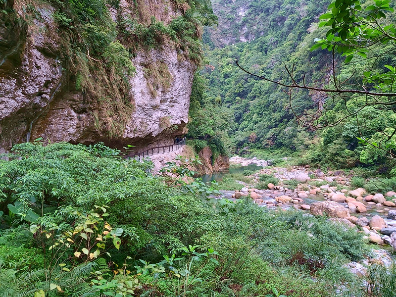
The beautiful turquoise color of the Shakadang River and the magnificent boulders and cliffs are the
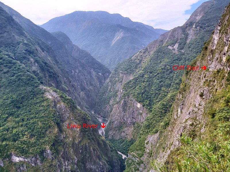
highlights of this hike. While 1,050 meters long, the Xiaozhuilu Trail is an excellent starter with a
beautiful view of the Liwu River before taking on the Shakadang Trail.
Before you go, please check whether Shakadang Trail is open. It may be closed even if the
website says partially open. I learned this the hard way.
A shout-out to Jamie W. for letting me know the latest update of Xiaozhuilu Trailhead and a kind offer to let me use his photos.
A shout-out to Jamie W. for letting me know the latest update of Xiaozhuilu Trailhead and a kind offer to let me use his photos.
Disclaimer:
All content is for inspiration only. Use Taiwan Hikes' suggestions at your own risk. We are not responsible for any losses, injuries, or damages.
Taiwan Hikes may include affiliate links. When you purchase through these links, you support our ability to continue providing FREE content — at no additional cost to you.
Table of Contents:
Exploring Taiwan? Save Time with the Ultimate 2025 Hiking Guide! Discover the top hikes in every city and
county across Taiwan—all accessible by public transport (bus links available). We've spent 50+ hours
researching the best trails and transit options, so you can skip the hassle and start your adventure!
About Shakadang
Shakadang Trail 砂卡礑步道 and Xiaozhuilu Trail are two of the famous trails in Taroko National Park, and very easy to
hike. You don't need to apply for permits to enjoy the beautiful scenery to hike there.
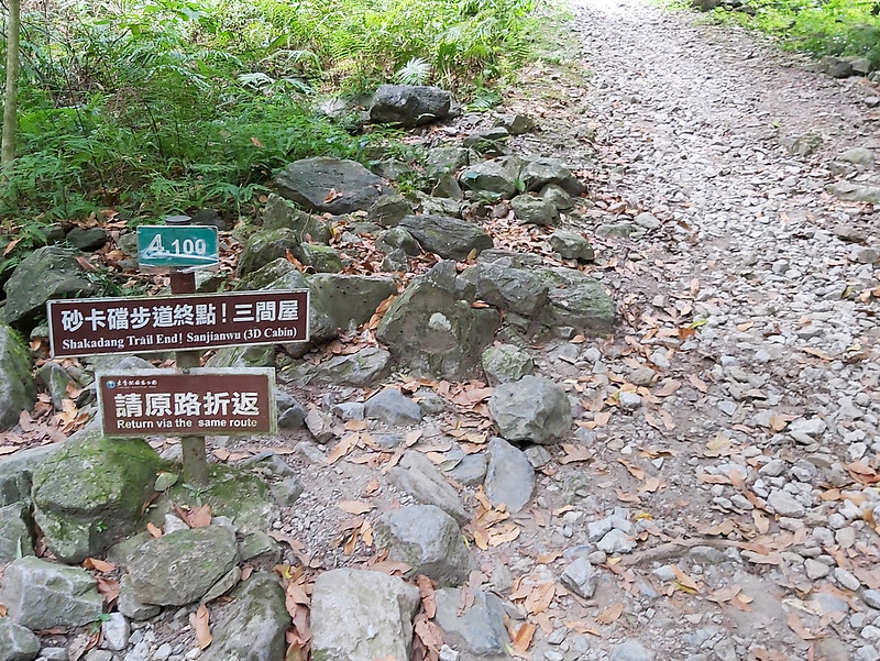
Shakadang Trail was built during Japanese Occupation and was meant for hydroelectric power. It is an
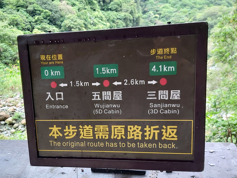
out-and-back trial and goes along with winding Shakadang River and ends at Sanjianwu. The one-way length of
Shakadang Trail is 4.1 km (2.54 miles). Shakadang River is a tributary of Liwu River, which helps create and shape the famous Taroko Gorge.
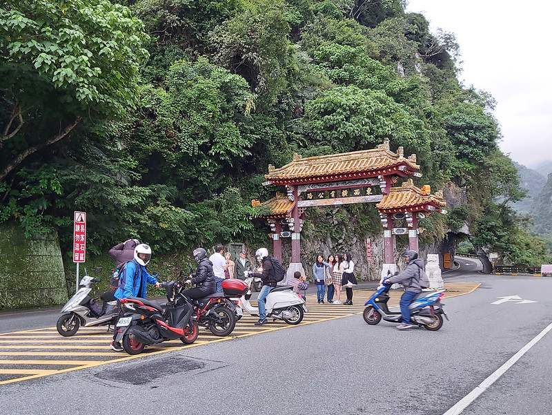
Taroko Entrance Gate or The Central Cross-Island Highway Gate 太魯閣閣口 or 東西橫貫公路牌樓
If you get off the ubss one stop earlier, you'll see this famous landmark near Jinwen Bridge 錦文橋 above Liwu
River. Central Cross-Island Highway (aka Provincial Highway 8) was built in July 1956 and was open to traffic
in May 1960. This gate is located on the east side of this highway, and has become the landmark of Taroko ever
since. Many tourists will take photos here. In 2005, Hualien County Government has listed this gate as the
important historical building.
Wujianwu and Sanjianwu
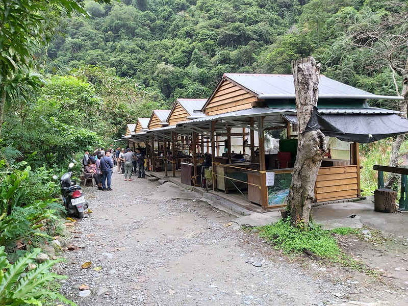
After you hike 1.5 km on Shakadang Trail and see five shops selling sausages and drinks and toilets on the
other side, you've reached Wujianwu. Wujianwu, aka 5D Cabin or Swiji, means five houses 五間屋 in Chinese. It's
old name is Swiji, meaning Banyan Tree with big leaves in the Truku (Taroko) language. In the old days, there
were five houses that belonged to Truku people. Therefore, this place is called Five Houses or Wujianwu. Trail
terrain after Wujianwu becomes more natural and rugged if you decide to hike further to Sanjianwu.
As to Sanjianwu 三間屋, san means three in Chinese. As you guess it, there were three houses in the old days
here. The old name of Sanjianwu is Brayaw 柏拉耀, meaning Giant Elephant's Ear in the Truku language. This is
because there were many those plants around Sanjianwu. Please note that the leaves and stems of Giant
Elephant's Ear are toxic, and DO NOT mix them with the edible taros.
Xiaozhuilu Trail
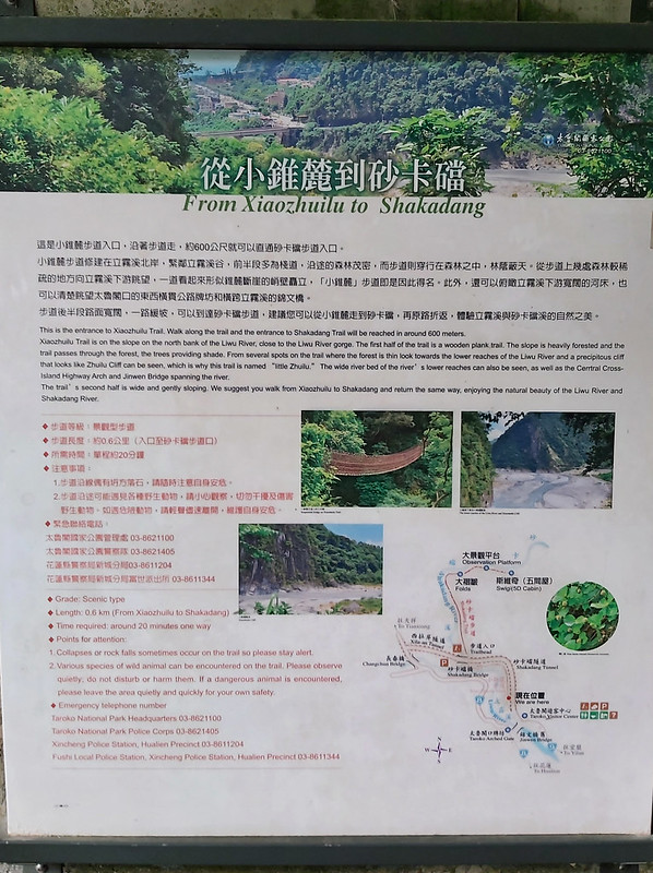
As to Xiaozhuilu Trail, it means little Zhuilu Trail in Chinese. It was built by Taroko National Park in 2014,
and it earned this name because its scenery looks like mini version of Zhuilu Old Trail. This trail is very short, only 650 meters (213 feet) long, and is
connected to Shakadang Trail. Therefore, it's highly recommended to take both Xiaozhuilu and Shakadang Trails.
Your support empowers Taiwan Hikes to create more FREE content, making your hiking adventures in Taiwan
even more enjoyable. Click "Buy Me A Coffee" or use our affiliate links to support.
How to Get There and Maps
- 1. You can take Ropo Bus 302 at Xincheng Train Station 新城火車站 and get off at Taroko Visitor Center.
- 2. Or take Hualien Bus 1133, 1126, or 1141 from Hualien Train Station and get off at Taroko Visitor Center. Please note that those buses will stop in downtown Hualien City, which will take longer to arrive at Taroko Visitor Center. Please note that you can also take Hualien Bus 1133A to Taroko Visitor Center, because it will not go to Hualien downtown and get to your destination at least 30 minutes faster depending on the traffic.
- 3. The faster bus to Taroko Visitor Center is Taiwan Tourist Shuttle Bus 台灣好行Taroko Route 310 at Hualien Train Station.
You actually don't need a GPX track to hike Xiaozhuilu and Shakadang trails. Just follow the signs. But you
can check out the map to see other trails I've done in Taroko.
A Hike to Stroll without the Need to Plan in Advance
Distance: 9.5 km (5.9 miles)
Brief itinerary: Taroko Visitor Center (Height 60 meters) ➔ Shakadang Tunnel ➔ Xiaozhuilu Trail (Height 60 meters) ➔ Shakadang Bridge and entrance of Shakadang Trail (Height 60 meters) ➔ Wujianwu ➔ Sanjianwu and return ➔ Shakadang Bridge ➔ Taroko Visitor Center
Brief itinerary: Taroko Visitor Center (Height 60 meters) ➔ Shakadang Tunnel ➔ Xiaozhuilu Trail (Height 60 meters) ➔ Shakadang Bridge and entrance of Shakadang Trail (Height 60 meters) ➔ Wujianwu ➔ Sanjianwu and return ➔ Shakadang Bridge ➔ Taroko Visitor Center
As I mentioned in my hike to Dali and Datong Villages in July 2020, this is my second time to do Shakadang Trail in
2020. I didn't plan to hike Shakadang Trail again, but I stayed at a hotel near Taroko Visitor Center for my
hike on Zhuilu Old Trail on the following day. Since I was there and got some time, I decided to
enjoy this beautiful trail again.
When I arrived at Hualien Train Station, it was raining, and I was worried that it would still be raining on
the day when I started to hike on Zhuilu Old Trail.
One thing to remember about the weather in Hualien is it changes all the time. By the time I arrived at my
hotel in Taroko in the early afternoon, the rain had stopped, which was wonderful.
It took me less than 1 km from my hotel to Taroko Visitor Center. When I saw Central Cross-island Highway
Gate, I took right to Jinwen Bridge to the visitor center. When I passed the entrance gate, many tourists
lined up taking photos with the gate. This was indeed a significant monument to be remembered.
An Unexpected but Pleasant Short Trail: Xiaozhuilu Trail
Before heading to Shakadang Tunnel, you will see Xiaozhuilu Trail. Xiaozhuilu Trail was built in 2014 and and
it underwent several constructions later.
Xiaozhuilu Trail was built along the side of Shakadang Tunnel in 2014 and and and it underwent several
constructions later. When I did this trail, it was under construction and I went inside Shakadang Tunnel and
took turn to Xiaozuilu Trail.
Jamie did the hike in late 2023, and according to Jamie, it feels longer than 1,050 meters, and the first
section is steeper and narrower than the rest of the section.
You can follow the footpath to continue.
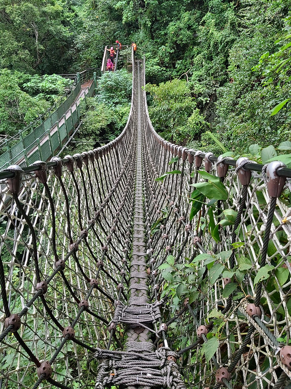
Take the stairs up and you will see something interesting.
It was a suspension bridge! Of course, I wanted to take this one. As you can see, it wasn't scary at all.
The trail terrain was in a good condition and children should have no problem walking here. Within a few
minutes, the Shakadang Bridge showed up. This is also the start of Shakadang Trail.
Turned to Shakadang Trail and Found Something New
If you don't take Xiaozhuilu Trail, the entrance of Shakadang Trail is underneath the bridge and you have to
take the staircase to get there.
Basically, you don't need a GPX or map to hike Shakadang Trail. This is an out-and-back trail, and you just
follow the well-maintained trail. If you are a tall person, please watch out your head.
If you take the whole trail, the round trip is 8.2 km. I only brought a small bag and some water, and I
started the hike late. So, I didn't plan to get to Sanjianwu, the end of the trail.
This trail went along with Shakadang River, which is 16 km (10 miles) long, and the color of the river was
beautiful turquoise.
The rocks on the other side of the river were amazing as well, like abstract paintings.
I walked as quick as I could because I was hoping to hike as much as I could before it was too dark. Suddenly,
I saw something in peripheral vision. I stopped and squatted down to take a closer look.
At a first glance, they looked like lilies. There were some purple buds and some white flowers with tiny
purple dots all over the flower paddles and the sticking out stamens. Those were gorgeous.
Later, I know those were 台灣油點草 Taiwan Toadlily. Those are
endemic species and seem to be very popular in Hualien. I saw Taiwan Toadlily again on my hike to Mt. Liushun and Qicai
Lake.
The Turquoise Blue That Never Changes
You can also turn back whenever you want, but at least try to get pass Wujianwu. There were some food venders
and toilets for you to take a break. You can see About Wujianwu
and Sanjianwu to know more about those places.
You can take a break at Wujianwu and try Maqaw sausage 馬告香腸. Maqaw is the Atayal name of May Chang or mountain pepper in Mandarin.

After Wujianwu, Shakadang River looked more impressive with huge boulders scattering in the water. The trail
terrain became more rugged, but still manageable.
The turquoise bule remained the same even when the weather wasn't good. I took this one when it was raining in
July 2020.
End the Day with A Wonderful Indigenous Meal
I didn't get to Sanjianwu because I didn't bring enough gear, so I decided to turn back after reaching
Aqueduct 大水管. There were some people dipping their toes in the water. It must be great to enjoy the river in
summer.
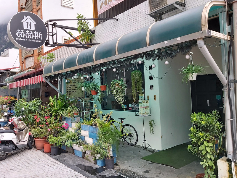
It took me much less time to get back to my hotel. After taking a short rest, I went to a restaurant that
served Truku food near my hotel, called Huhus Restaurant.
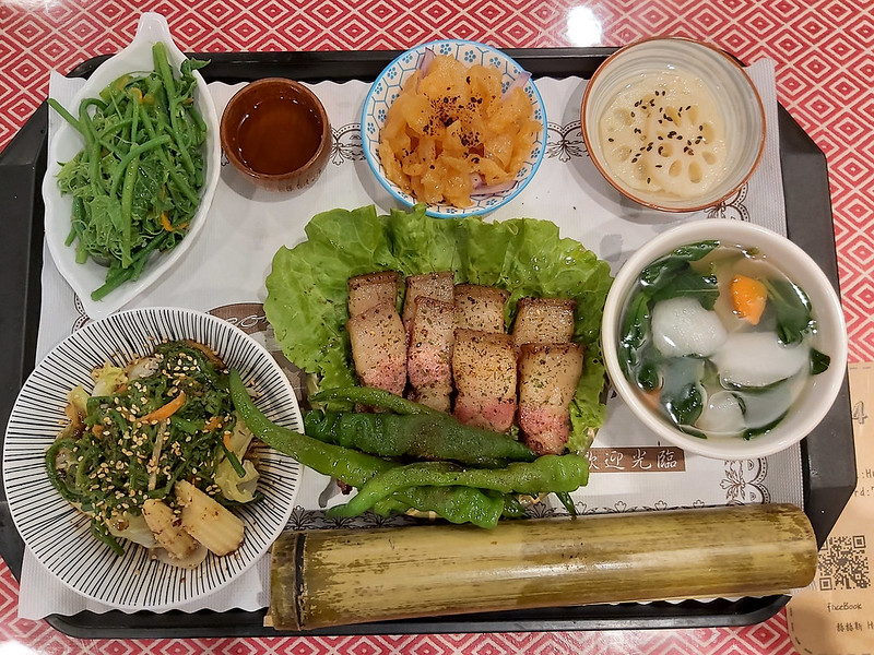
In Truku, huhus means the sounds made by snakes, and it was also the old name of Dali Village. I ordered BBQ Pork served with side dishes and
bamboo rice 火烤鹹豬肉套餐, and it was so delicious, and the potion was so big that I was so full.
This was Truku rice wine, and it tasted so smooth. I usually don't dare to try rice wine, because of its
pungent smell, but this one was different. But if I drank this too much, I probably wouldn't be able to do my
Zhuilu Old Trail on the next day. It was a great meal to end the day.
Other Trails Nearby to Enjoy
There are so many things you can do and see in Taroko, and Shakadang Trail and Xiaozhuilu Trail are one of
them. Those trails are short and easy to hike and you can totally do it without a guide.
If you can stay in Taroko Gorge for several days, you can spend one day on Shakadang Trail and Xiaozhuilu
Trail, and Taroko Visitor Center for one day, and Zhuilu Old Trail, Yanzikou, and Tunnel of Nine Turns for the second day, and the rest of
Taroko Gore on the third day. Shanyue Suspension Bridge is also a good option.
If you opt for challenging trail and get inside the local people's life, you should take the trail to Dali and Datong villages, and stay there for one night. I promise you this is a trail
that you will want to do it again.
Just take your time to enjoy amazing Taroko Gorge without a rush and discover the beauty of the nature wonder.
Have you been to Taroko? What trails did you go when you were there? Please leave comments below. Don't forget
to subscribe to newsletters to know more about the exciting trails in Taiwan.
How to Apply for Hiking Permits in Taiwan, Or Hire Me!
A Handy Guide to Applying for Hiking Permits in Taiwan
You don't need to apply for permits to hike Shakadang or Xiaozhuilu Trail, but you might do more trails later.
You can download my guide "How to Plan and Apply for Hiking Permits in Taiwan" by clicking the image
below for details.
Disclaimer:
All content provided is for inspirational and informational purposes only. Creating, using, hiking, or traveling with Taiwan Hikes' suggested services or itineraries is at your own risk. Please use your best judgment and follow all safety precautions, as Taiwan Hikes and Anusha Lee are not liable for any losses, injuries, or damages from using this information.
Please also note that Taiwanese government agencies tend to change their URLs without bothering to redirect to the new ones. As a result, you will find some external sites on the Taiwan Hikes website are not working from time to time. Taiwan Hikes will try to update those URLs if possible.
Taiwan Hikes is not responsible for the content of external sites.


