Lie Ren Trail aka Hunters Trail in Wangxiang Village
Lie Ren Trail, aka Hunters Trail, is the most popular hike in Wangxiang Village in central Taiwan. Although
Wangxiang is small, this village is surrounded by two major mountain ranges, Yushan Mountain Range and Alishan
Mountain Range. For local people, seeing 100 Peaks is like seeing highrises for city dwellers, except that
those mountains are ten times much better.

Disclaimer:
All content is for inspiration only. Use Taiwan Hikes' suggestions at your own risk. We are not responsible for any losses, injuries, or damages.
Taiwan Hikes may include affiliate links. When you purchase through these links, you support our ability to continue providing FREE content — at no additional cost to you.
Table of Contents:
- About Wangxiang and Hunters Trail: Open the Door and You See the Mountains
- How to Get There
- Peaks and Places to Reach
- An Easy Hike to Hunters with the Highest Mountain by Your Side
- Excellent Views on Mt. Wangmei and Wanggaoliao Lookout
- Very Challenging Hike to Mt. Qiong
- Thoughts about This Hike: Enjoy Wangxiang's Slow Life and Blossoms
- Map and Itinerary
- Recommended Blogs and Resources
- Related Posts on Taiwan Hikes
Exploring Taiwan? Save Time with the Ultimate 2025 Hiking Guide! Discover the top hikes in every city and
county across Taiwan—all accessible by public transport (bus links available). We've spent 50+ hours
researching the best trails and transit options, so you can skip the hassle and start your adventure!
About Wangxiang and Hunters Trail: Open the Door and You See the Mountains
There is a Chinese idiom 開門見山 (Kāi mén jiàn shān), and it literally means 'open the door and you see the
mountains'. It actually means 'spit it out', 'cut to the chase', or 'let's talk turkey' in English. However,
in Kalibuan, aka Wangxiang Village 望鄉部落, it really means you see the mountains when you open the door.
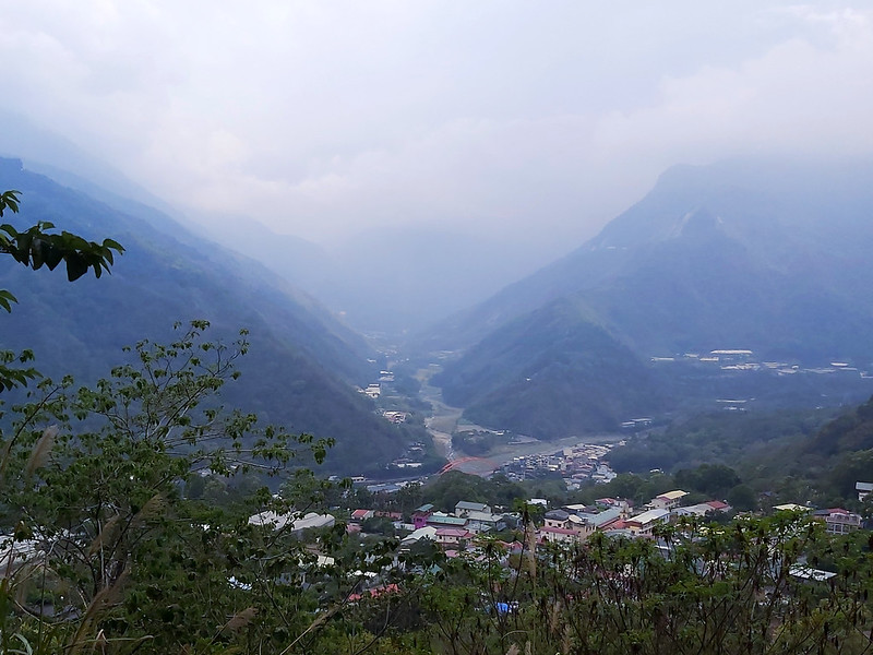
Furthermore, what you see are not just mountains but the highest mountain in Taiwan, Mt. Yu (aka Mt. Jade),
3,952 meters (12,966 feet). So here in Wangxiang, you open the door, and you see Mt. Yu. This video was shot
in November 2019 during my first visit. Please excuse my lousy video shooting skill.
Kalibuan aka Wangxiang Village
Wangxiang Village is located in Xinyi Township Nantou County 南投信義鄉, at an altitude of 900 meters. Bunun
people, the main residents living here, call this place Kalibuan. Wangxiang is also in between Sun Moon Lake, Yushan National Park and Alishan
National Scenic Area, but belongs to Alishan Mountain Range.
The residents of Wangxiang were originally from Mt. Luanda (Luandashan) 巒大山 in the Central Mountain Range.
During Japan Occupation, they were forced to relocate to the current location. Before they moved, the elders
in the tribe kept reminding them never leave Mt. Yu out of sight. Mt. Yu is deemed as the sacred mountain for
Bunun people. After moving here, Bunun people found Kalibu, Strawberry Trees 楊梅, all over the mountains.
Therefore, they called this place Kalibuan, meaning lush trees.
During that time, a homesick Japanese soldier called this place Bukiu, meaning missing home in Japanese.
Later, Wangxiang, literally meaning missing home in Chinese, became the official name.
Because of this unique location, you can see many mountains including several 100 Peaks in Wangxiang, Mt. Jyunda 郡大山 (3,263 meters), Mt. Batongguan 八通關山 (3,335 meters), Mt. Yu Main
Peak 玉山主峰 (3,952 meters), and Mt. Yu North Peak 玉山北峰 (3,858 meters).
Christmas Torch Festival: Experience Different Christmas in Wangxiang Village
Most indigenous people in Taiwan are Christians and Christmas celebrations are big things in those villages,
especially in Wangxiang. Everyone in the village would carry a torch, parade together, visit the next
household, light up their torches and proceed to the next one to convey the blessings, which was also called
Torch Festival 火把節. It has become very popular for hikers and tourists to celebrate Christmas in Wangxiang
together, at least before Covid-19 pandemic. You can watch this video by MIT Taiwan Diary MIT
台灣誌, a popular hiking TV program in Taiwan, to see what the Christmas celebrations were like.
I'm not sure Torch Festival will still be there in 2021 because of Covid-19 outbreaks in Taiwan. At least,
this can be something to look forward to in the future.
Your support empowers Taiwan Hikes to create more FREE content, making your hiking adventures in Taiwan
even more enjoyable. Click "Buy Me A Coffee" or use our affiliate links to support.
Hunters Trail, Mt. Wangmei and Wanggaoliao Lookout
Hunters Trail used to be called Manutusan Hunters Trail 馬奴多斯獵人古道, and it was Bunun people's hunting ground.
This trail started from the back of the village and extended all the way up to Mt. Wangmei. The terrain looked
like the contour of nose according to Bunun people, which was Manutusan in Bunun language.
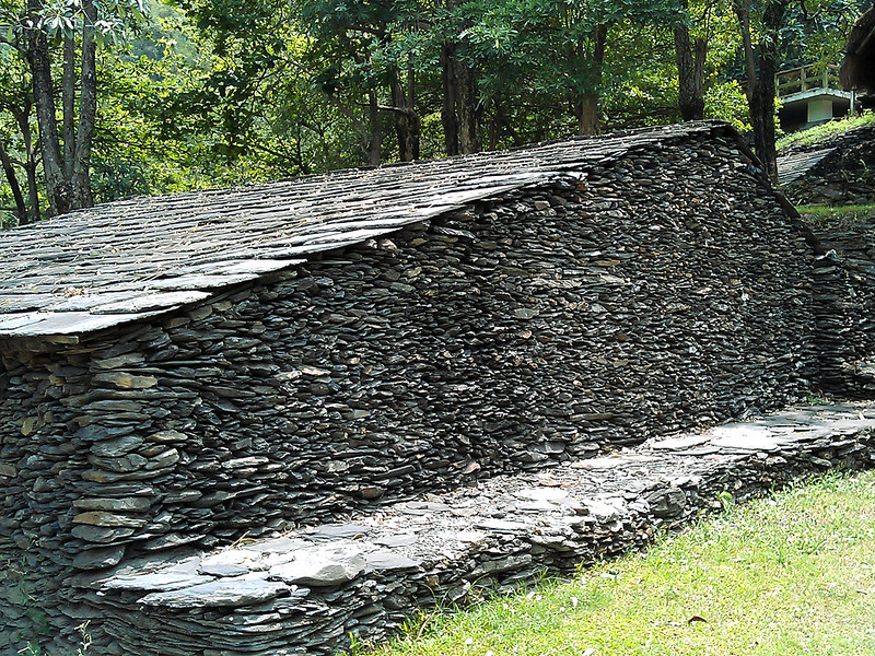
There are several indigenous tribes in Taiwan that make slate houses, and Bunun people are one of them. On the
way to Mt. Wangmei, you'll see a beautiful slate pavilion and you must stop here to enjoy the amazing view and
this beautiful structure. This slate pavilion was made with Bunun's traditional construction techniques, and
those slates were transported from Sandimen Township from Pingtung County 屏東三地門 in the south of Taiwan,
because Wangxiang doesn't have mines to produce those slates. The purpose was to preserve Bunun's culture.
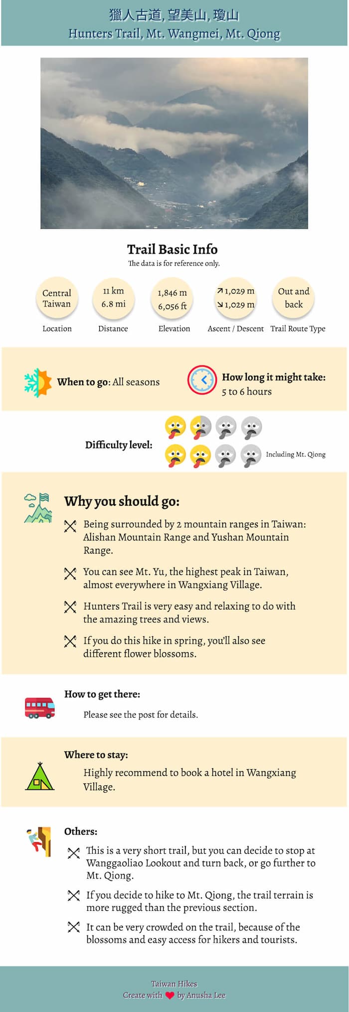
This trail is an out-and-back trail, starting from the trailhead at Wangxiang Village via Mt. Wangmei to
Wanggaoliao Lookout. Although we can see Mt. Yu from this trail, this area belongs to Alishan Range, not Mt.
Yu. This is very short and easy trail to hike, and the one-way distance is only 2.8 km (1.74 miles).
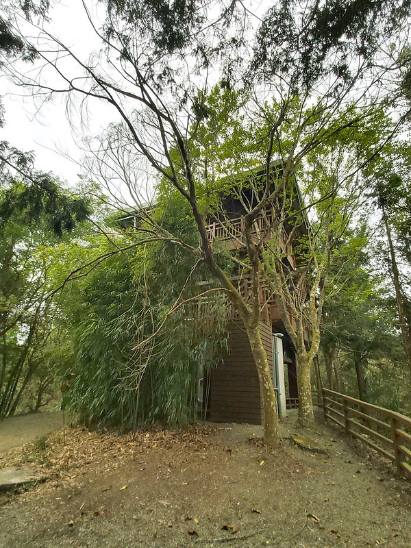
Wanggaoliao Lookout used to monitor forest fire during Japan Occupation, and it was remodeled as a 3-floor
wooden structure. The views on the third floor are great when the weather is good.
Mt. Qiong
After reaching Wanggaoliao Lookout, you can turn back to the trailhead or continue your hike to Mt. Qiong,
1,846 meters (6,056 feet). Please note that the trail terrains and the grades of the slopes are much more
difficult than the previous section, and there's no view on the peak.
But if you are super fit, you can continue your hike to Mt. Song 松山 (the exact Chinese of Songshan Airport in
Taipei City), 2,557 meters (1,9869 feet). There's a junction on Mt. Song. One trail goes to famous hiking
trail Mianyue Line 眠月線 (permits required) and Mt. Data, and the other goes to another famous trail,
Shuiyang Forest or Shuiyang Lake 水漾森林, a post-quake
lake.
How to Get There
You will have to transfer several buses to get there if you don't drive.
From Taichung to Shueili Nantou
Please check All Day Bus 總達客運 for those buses from Taichung to Shuili 水里: 6333, 6333A, 6333B,
and 6322. Bus 6333B will stop at High Speed Rail Taichung Station, too.
From Shuili Train Station to Wangxiang Village
Take Yuanlin Bus 員林客運 6733 and get off at Tongfu Junior High School 同富國中.
Or take the Dongpu Route of Taiwan Tourist Shuttle 台灣好行 東埔線,
get off at Tongfu Junior High School 同富國中.
From Bus Stop to the Trailhead
After getting off at Tongfu Junior High School stop, please use navigation in the Google Maps by checking the
coordinates of the trailhead of Hunters Trail: 23.602417, 120.885642.
Please note that there will be less bus schedules or regulations due to Covid-19 pandemic. Check with the
bus companies before you go.
Peaks and Places to Reach
Mt. Wangmei 望美山, 1,427 meters (4,682 feet).
Wanggaoliao Lookout 望高寮瞭望台, 1,517 meters (4,977 feet).
Mt. Qiong 瓊山, 1,846 meters (6,056 feet).
Wanggaoliao Lookout 望高寮瞭望台, 1,517 meters (4,977 feet).
Mt. Qiong 瓊山, 1,846 meters (6,056 feet).
An Easy Hike to Hunters Trail with the Highest Mountain by Your Side
Distance: 11 km (6.8 miles)
Brief itinerary: Trailhead of Hunter Trail (Height 900 meters) ➔ Pavilion ➔ Mt. Wangmei (Height 1,427 meters) ➔ Wanggaoliao Lookout (Height 1,517 meters) ➔ Mt. Qiong (Height 1,846 meters) ➔ Lookout ➔ Mt. Wangmei ➔ Pavilion ➔ Trailhead of Hunter Trail
GPS coordinates of Hunter Trailhead: 23.602417, 120.885642
Note: This is a two-day hike including a 100-Peaks mountain, Mt. Jyunda, but I think Hunters Trail can be a standalone trip because there are
many other things to do in Wangxiang Village.
I've been to Wangxing Village to do my Mt. Zhizhong hike near Alishan in November 2019. I was very impressed by the
mountains including Mt. Yu Main Peak, around us when we got up early to the trailhead.
This time was no exception. Once we arrived at our B&B, our guides told us that we could see Mt. Yu Main
Peak and Mt. Batongguan, 3,335 meters (10,942 ft) and other 100 Peaks from the second floor. It's really 'Kāi
mén jiàn shān', open the door and you see the mountains. I was going to hike Mt. Batongguan and Mt. Yu Main
Peak in August 2021, but it was cancelled due to the Covid-19 outbreak in Taiwan. But I didn't know that when
I saw those amazing mountains at our B&B and I believed I would be there soon.
Took Photos with Our Guide Who Just 'Wanbai'
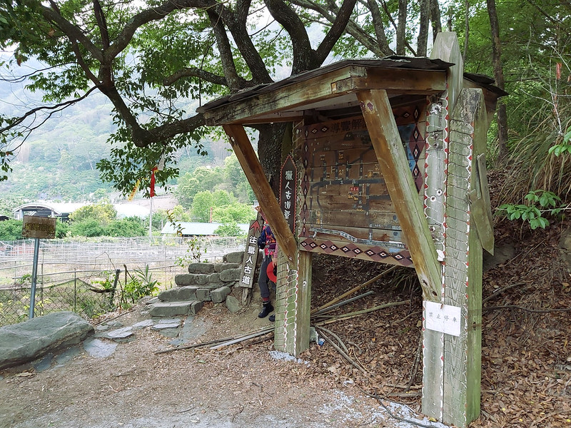
Soon, we arrived at the trailhead of Hunters Trail. It was very easy to recognize the trailhead, because there
was a hand-made map with the details you need to know. We stayed here a little bit longer because we had to
follow the photo taking routine.
I took a photo with one of our guides for a very good reason. This petite lady, Rose, was a few years younger
than me, but she was really tough. I've been hiking with her for several times, including my alpine lake hike: Qicai
Lake. She once broke her foot on the trail but still managed to finish it on her own. After she visited
the doctor, she realized that she got a broken ankle. She had a foot surgery, took a break for a few months,
and got back to the trails later. Now, she's finished all the 100 Peaks in Taiwan! In Taiwan, we call this
'wanbai 完百', literally meaning finishing 100 Peaks.
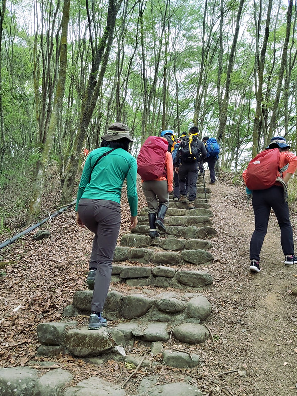
The trail started with steps. Usually, the trails with steps are quite easy to hike in Taiwan. This one was no
exception.
Then we reached a junction, but it was obvious to take the left one without the need to read a map, because
you can see the nurmerous plastic ribbons left by other hiking groups. We did the same thing in the following
junctions.
We passed many plum trees, and those plums were ready to be harvested. I actually bought a jar of preserved
plums made by the shop next to our B&B after this hike.
The Beautiful Slate Pavilion with Stunning Views
Soon, we reached the slate pavilion that we had been waiting for. Those slates were neatly placed on the top
of each other, with a painting depicting a fire roasting two boars.
Although we didn't have a great weather on that day, this was still breath taking.
After this cute slate pavilion, we hiked on the ridge, passing farms and trees that looked like Acer
serrulatum Hayata 青楓. If I am right, this is an endemic species in Taiwan.
Before turning left at the junction, we stopped to check out trees with small ruby-like fruits. I was told
those were Taiwan Cherry 山櫻花 or 緋寒櫻, and the blossom seasons were in January and February.
After several turns, we went into Moso bamboo woods.
Having Fun with the Rope Swing in the Woods
After another uphill with steps, we reached a flat resting area with a ROPE SWING! We had fun there. It was
said this was also the BBQ area for people, but I hoped not, because this place was too good to do BBQ.
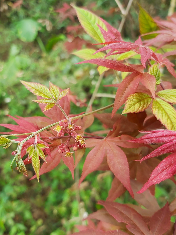
While waiting for everyone to have fun, I checked out the trees around us, and the red leaves out of the green
caught my attention. After Googling, some hikers said those were Acer palmatum 'Atropurpureum', Japanese
Maple, 紫葉槭. Japanese Maple's leaves turn purplish red in summer, which was a great surprise to see them here.
You can also see many Japanese Maple at Mt. Taiping or Taipingshan.
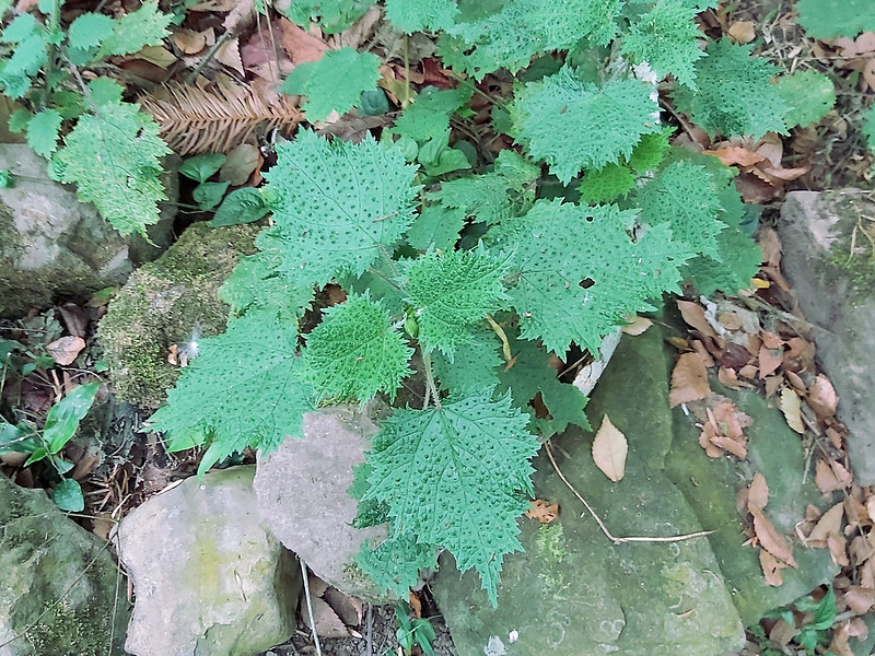
While enjoy the swing and the beautiful trees, please be aware of Stinging Nettle 咬人貓 hiding in the bush to
kick your butt.
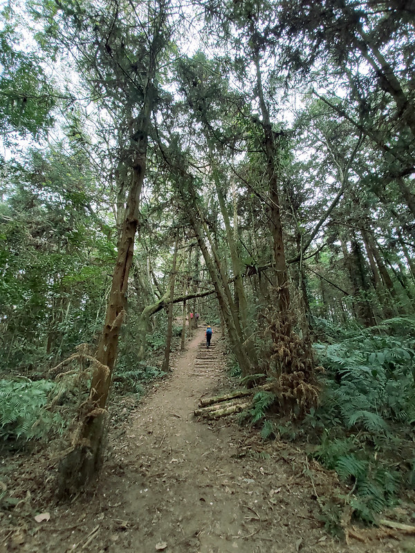
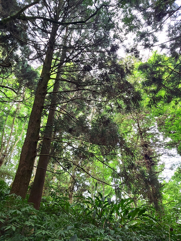
After the fun time, we continued our hike and were flanked by Japanese Cedar Trees and other tall trees.
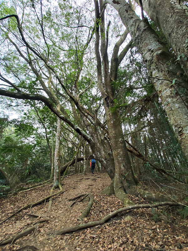
Then we went under Taiwan Acacia 相思樹 with their thick tree trunks stretching just slightly above our heads.
The variety of plants here was amazing.
Excellent Views on Mt. Wangmei and Wanggaoliao Lookout
Then, I saw a stone pillar carved with 台大(國)923. Seeing this means you are very close to Mt. Wangmei, because
this area is the experimental forest that belongs to National Taiwan University.
Within 5 minutes, we reached Mt. Wangmei.
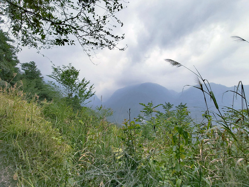
It was a shame that we didn't have a good weather to see very far from Mt. Wangmei. At least, it wasn't
raining. But during that period of time, Taiwan was experiencing the most severe droughts for years.
We took the right trail and went uphill. According to other hikers, the left one will take you to Wanggaoliao
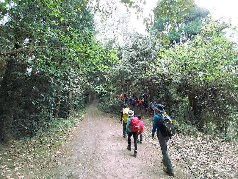
Forest Road and back to Wangxiang Village, about 6.4 km (4 miles). The road terrain was like what you see in
the photo, with the Japanese Cedar Trees on both sides. You can do a loop hike if you take this one.
It didn't take us long to reach Wanggaoliao Lookout, just around 15 minutes. The lookout was a 3-story wooden
structure and was big enough for many hikers and tourists to take a break.
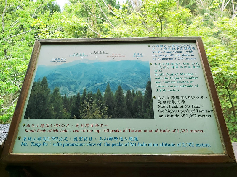
You'll see signs telling you what mountains you are looking at, but it was cloudy when we got there.
While taking a break, our guides asked us whether anyone wanted to continue the hike to Mt. Qiong. I raised my
hand right away. Of course, I would. I was planning to do several 100 Peaks hikes and I needed to do more
training, although all of them got cancelled later thanks to the pandemic.
Very Challenging Hike to Mt. Qiong
The following hike was led by one of my favorite guides, Xiao Tsai. He knew I was the slowest one (or the
second slowest), and I didn't let him down this time, either. He was very kind to check on me constantly to
make sure I was ok. I reassured him through my huffing and puffing that I was fine.
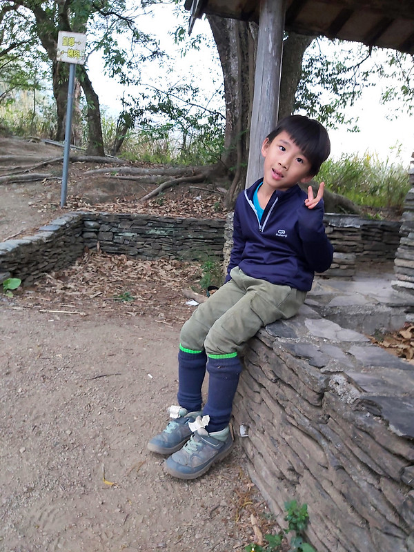
One thing worth mentioning is we had second grader in our group, a cute little boy who had extreme energy on
this trail. According to his father, he had finished several 100 Peaks in Taiwan.
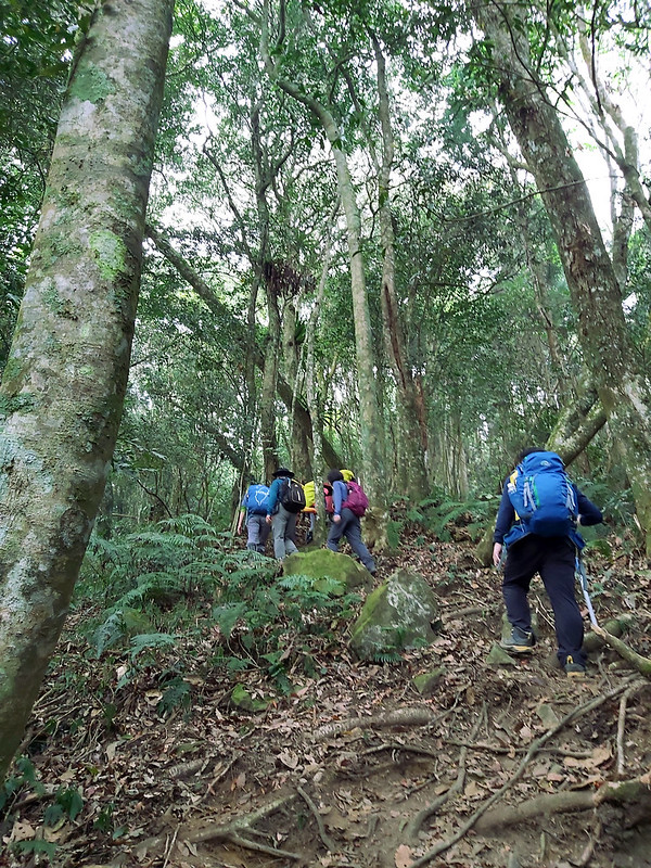
The trail was mostly on the ridge, but it was hidden in the thick woods without seeing any views, except for
the tall and handsome trees. This whole area was the Experimental Forest of National Taiwan University.
The one-way trip from the lookout was only 1 km with total ascent of 300 meters to Mt. Qiong. It took us
around 30 minutes to get to the peak. I could hear the cute little boy's Baba (meaning father in Chinese)
through my excessively loud breathing all the way to the top.
There wasn't much to see on the peak. We left around 3 pm, after taking enough photos. By the time we reached
the trailhead, it was 6 pm sharp. We were tired and hungry and ready to devour the dinner.
Thoughts about This Hike: Enjoy Wangxiang's Slow Life and Blossoms
There are some places that will make you keep coming back, and this is one of them. Not just for Hunters
Trail, but also for Wangxiang Village. Being surrounded by the high mountains and seeing Bunun's sacred
mountain Mt. Yu whenever you open the door (or windows) is so mesmerizing.
Moreover, after watching the video of how Wangxiang Village celebrated Christmas, I even consider to be part
of the crowds to experience Bunun people's culture and hospitality, even though I'm pretty much a loner who
doesn't celebrate most holidays.
There are different ways to enjoy this hike, either an out-and-back one or taking Wanggaoliao Forest Road
望高寮林道 to make it a loop hike. Both are very easy to do. You can even arrange this hike in all seasons to see
blossoms, fall foliage, or just enjoy the stunning views and Mt. Yu from the slate pavilion.

Most hikers in Taiwan will arrange a two-day trip at Wangxiang Village: do Hunters Trail on the first day and
hike to Mt. Jyunda on the second day. This is also what our group did.
What do you think about Wangxiang Village and Hunters Trail? Please leave comments below. Don't forget to
subscribe to newsletters for more amazing trails in Taiwan.
Map and Itinerary
Based on my hike on April 10, 2021
07:00
Left Banqiao, New Taipei City
11:35
Arrived at B&B
12:20
Left B&B for Hunters Trail
12:33
Arrived at the trailhead of Hunters Trail
12:42
Reached the first junction and turned and right. Then turned
right again.
12:45
Reached a slate pavilion with the amazing view
13:20
Arrived at a junction and turned left
13:26
Took a break in the bamboo woods
13:30
Arrived at an area with a rope swing hanging from the tree. We
had fun there for about 20 minutes.
14:07
Passed a concrete pillar with words 台大(國)923
14:12
Reached Mt. Wangmei
14:18
Reached a junction and took the right to go up. Then, another
junction and took the right with the sign Lookout
14:31
Arrived at Wanggaoliao lookout and took a break
14:53
Left the lookout and headed to Mt. Qiong
15:55
Arrived at Mt. Qiong
16:56
Back to the lookout
17:09
Back to Mt. Wangmei
17:25
Back to the swing
17:52
Back to the slate pavilion
18:00
Back to the trailhead
Total time:
5 hours 40 minutes, including long breaks


