(Closed) Zhuilu Old Trail: An Epic Cliff Hike in Taroko Gorge
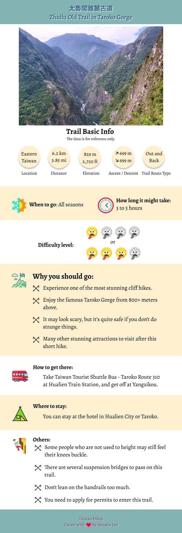
Zhuilu Old Trail is one of the most exciting cliff hikes above Taroko Gorge in Hualien. It's a short trail yet
with rich history and stunning views overseeing the deep valley cut by Liwu River. This is an exciting tour
you can't miss when visiting Taroko Gorge in Taiwan.

Disclaimer:
All content is for inspiration only. Use Taiwan Hikes' suggestions at your own risk. We are not responsible for any losses, injuries, or damages.
Taiwan Hikes may include affiliate links. When you purchase through these links, you support our ability to continue providing FREE content — at no additional cost to you.
Table of Contents:
- About Hehuan Traversing Old Trail and Zhuilu Old Trail
- How to Get There
- How to Apply for Permits to Hike Zhuilu Old Trail
- On the Previous Day: A Warm-up at Xiaozhuilu Trail and Shakandang Trail
- A Glimpse of Taroko before The Thrilling Cliff Hike
- Finally, Walk along with the Cliffs above 700 Meters!
- Thoughts about This Hike: A Trail That Hasn't Finished Yet
- Map and Itinerary
- Related Posts
About Hehuan Traversing Old Trail and Zhuilu Old Trail
Before we talk about Zhuilu Old Trail, we need to talk about 合歡越嶺古道 Cross-Hehuan Mountain Old Road aka Hehuan Traversing Old Trail. Hehuan
Traversing Old Trail started from Puli Nantou 埔里南投 on the west side of Taiwan, via Wushe 霧社, Sanjiaofeng
(Sanjiao Peak) 三角峰, Yingyingfeng (Yingying Peak) 櫻櫻峰 (Note 1), and Hehuan Saddle 合歡鞍部 (Note 2). Then, the
trail crossed the Central Mountain Range and got into Liwu River Basin, via Guanyuan 關原, Tuobokuo 托博闊, Kalabao
卡拉寶, Gugaiyang 古白楊, to Tabiduo (now called Tiansiang) 塔比多(天祥) and Badagang 巴達岡 and other tribes on the east.

Here is the original content from The Council of Agriculture's website:
"合歡越嶺道西自南投埔里起,經霧社、三角峰、櫻峰、合歡鞍部,翻越中央山脈,進入立霧溪流域關原、托博闊、卡拉寶、古白楊,到達東岸之塔比多(天祥)、巴達岡等部落。"
When Hehuan Traversing Old Trail was built in 1914 during Japanese Occupation, it was meant to force and
coerce indigenous people, the Truku (Taroko) people 太魯閣族, to
succumb to Japanese government.
In 1950s, Taiwan government decided to connect the west with the east via Hehuan Traversing Old Trail and
built Central Cross-island Highway. As a result, most of Hehuan
Traversing Old Trail was gone and replaced by modern highway, only sections of the old trail were left. Lucky
for us, Zhuilu Old Trail is one of the sections left on the east side of Taiwan.
If you are interested in old trails in Taiwan, you can check out videos, Ancient Trails of Taiwan, produced by Taiwan Public Television Service. If
you still can find those videos, please kindly let me know.
The total length of Zhuilu Old Trail was 10.3 km (6.4 miles) from Zhuilu Suspension Bridge 錐麓吊橋 to Cimu Bridge
慈母橋, but now we can only hike 3.1 km to Cliff Outpost 斷崖駐在所 and return to Zhuilu Suspension Bridge. The rest
is closed due to the damaged trail and risk of falling rocks.
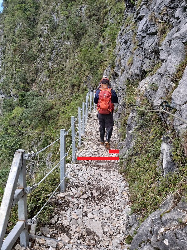
When it was built, the cliff trail was only 30 cm (12 inches) wide. Japanese government compulsorily recruited
the indigenous men to expand the trail to 1.5 meters (4.9 feet) in width. But if you are afraid of height, the
Zhuilu cliff section might still make your palms sweat and knees buckle.
You need to apply for permits to hike Zhuilu Old Trail, and the time to enter the trail is between 7:00 am and
10:00 am. The ticket price per adult is NT$200. You need to get your ID ready when entering the trail.
Note 1:
Due to typo, Yingyingfeng 櫻櫻峰 was supposed to be Yingfeng 櫻峰. Now, we can only find Yingyingfeng on the map. So, I change it to Yingyingfeng.
Due to typo, Yingyingfeng 櫻櫻峰 was supposed to be Yingfeng 櫻峰. Now, we can only find Yingyingfeng on the map. So, I change it to Yingyingfeng.
Note 2:
I have been wondering what Hehuan Saddle was when it was mentioned on the page of The Council of Agriculture. At first, I thought it was Wuling 武嶺, but it didn't seem right to me. Later, I found a paragraph mentioned by a hiker's post: "1935年日人修築合歡越嶺道時,在石門山北側鞍部鑿成一個隧道,並依此命名為「石門」". Translation: When Japanese built Hehuan Traversing Trail, they dug a tunnel at a saddle on the north of Mt. Shihmen and named this Mt. Shihmen. So, my guess is, Hehuan Saddle here refers to Mt. Shihmen 石門山, 3,237 meters (10,620 feet), which is also a 100 Peaks 百岳 and the easiest one to hike. If you know what Hehuan Saddle referred to in the old days, please feel free to let me know. I appreciate your help.
I have been wondering what Hehuan Saddle was when it was mentioned on the page of The Council of Agriculture. At first, I thought it was Wuling 武嶺, but it didn't seem right to me. Later, I found a paragraph mentioned by a hiker's post: "1935年日人修築合歡越嶺道時,在石門山北側鞍部鑿成一個隧道,並依此命名為「石門」". Translation: When Japanese built Hehuan Traversing Trail, they dug a tunnel at a saddle on the north of Mt. Shihmen and named this Mt. Shihmen. So, my guess is, Hehuan Saddle here refers to Mt. Shihmen 石門山, 3,237 meters (10,620 feet), which is also a 100 Peaks 百岳 and the easiest one to hike. If you know what Hehuan Saddle referred to in the old days, please feel free to let me know. I appreciate your help.
How to Get There
Since we are only allowed to hike from Zhuilu Suspension Bridge to Cliff Outpost, there is only one trailhead,
which is located at Yanzikou (aka Swallow Grotto).
- 1. You can take Ropo Bus 302 at Xincheng Train Station 新城火車站 and get off at Yanzikou (aka Swallow Cave or Swallow Grotto) Stop 燕子口.
- 2. Or take Hualien Bus 1133, 1126, or 1141 from Hualien Train Station and get off at Yanzikou (Swallow Grotto) Stop. Please note that those buses will stop in downtown Hualien City, which will take longer to arrive at Yanzikou (Swallow Grotto) Stop. Please note that you can also take Hualien Bus 1133A to Taroko Visitor Center, because it will not go to Hualien downtown and get to your destination 30 minutes faster depending on the traffic.
- 3. The fastest bus to get to Swallow Cave Stop is Taiwan Tourist Shuttle Bus 台灣好行 Taroko Route 310 at Hualien Train Station.
When you get off at Yanzikou (Swallow Grotto), you will find toilets if you continue to walk another 0.6 km
(0.37 miles). This trip is totally worth it because you'll get the see the spectacular Taroko Gorge.
How to Apply for Permits to Hike Zhuilu Old Trail
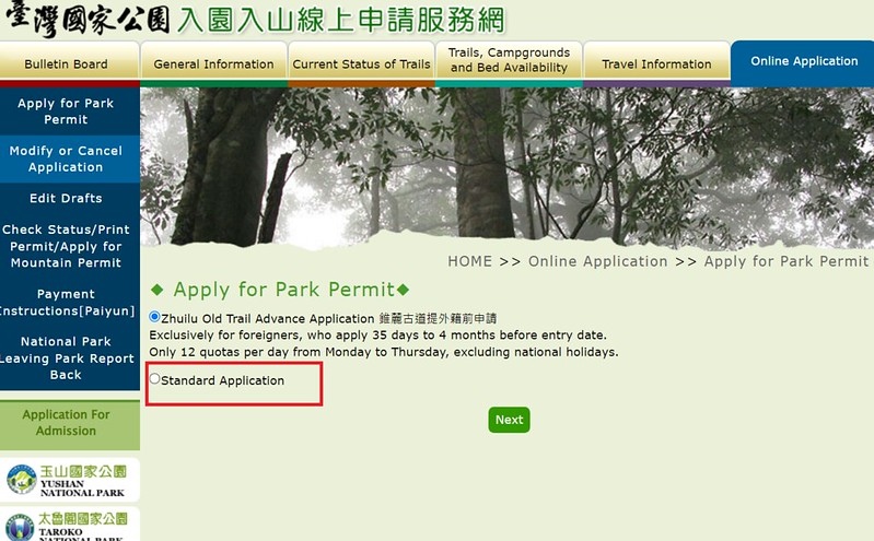
National Park Permits (Park Permits):
National Parks set up a new website saying the application process is easier. However, I still think the old
one is relatively better (but still could be better). Here is the Taroko National Park permit application website.
Read and check all the boxes required and click "I Agree" on the next page.
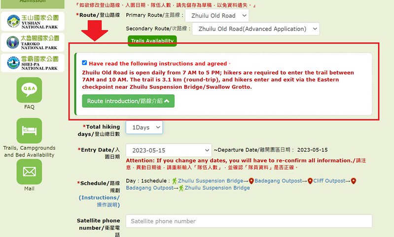
On the next page, please fill out the information and the date you want to hike. Pick a team name, and then
select "Zhuilu Old Road". The system will select the secondary route for you.
Although Zhuilu Old Trail is open between 7 am and 5 pm daily, visitors have to check in at the checkpoint and
start their hike before 10 am to ensure they will return safely before it's too dark.
You don't need to apply for Police Mountain Entry Permit (short for Police Permit)
Please get a printout of your permit and bring your ID with you when checking in at the checkpoint. You pay
the admission fee of NT$200 at the checkpoint.
How to Plan and Apply for Hiking Permits in Taiwan
You can download my guides by clicking the image below for details.
On the Previous Day: A Warm-up at Xiaozhuilu Trail and Shakandang Trail
Because I had to go to Hualien from Taipei to do this hike, I booked train tickets and a hotel near the
trailhead. I was thinking about staying at a hotel in Hualien City, but I changed my mind and booked one near
Taroko Visitor Center instead, which turned out to be a great
decision.
I arrived at Hualien Train Station around noon, and it rained a lot. This made me doubt I would have a good
weather the next day when I hiked Zhuilu Old Trail. Luckily, when I arrived at my hotel near Taroko Visitor
Center, the rain stopped, and I could go out to look around. I decided to go to Shakandang Trail 砂卡礑步道 again.
This was my second time to visit Shakandang Trail in 2020. In July 2020, I hiked Dali and Datong Tribes
and then took Shakandang Trail back to Taroko Visitor Center.
This time, I also took Xiaozhuilu Trail 小錐麓古道 (aka Little Zhuilu Trail).
A Glimpse of Taroko before The Thrilling Cliff Hike
Distance: 6.2 km (3.85 miles)
Brief itinerary: Yanzikou (Swallow Grotto) (Height 274 meters) ➔ Badagang Outpost (Height 450 meters) ➔ No. 2 Badagang Suspension Bridg (Height 520 meters) ➔ Zhuilu Cliffs Starting Point (Height 765 meters) ➔ Cliff Outpst (Height 720 meters) ➔ Zhuilu Cliffs ➔ No. 2 Badagang Suspension Bridg ➔ Badagang Outpost ➔ Yanzikou
GPS coordinates of the trailhead: 24.173221, 121.566598
Places to reach:
Yanzikou (Swallow Grotto): 燕子口, height 274 meters
Zhuilu Suspension Bridge: 錐麓吊橋
Badagang Outpost: 巴達岡駐在所, height 450 meters
Cliff Outpost: 斷崖駐在所, height 720 meters
Yanzikou (Swallow Grotto): 燕子口, height 274 meters
Zhuilu Suspension Bridge: 錐麓吊橋
Badagang Outpost: 巴達岡駐在所, height 450 meters
Cliff Outpost: 斷崖駐在所, height 720 meters
I'd been wanting to hike on Zhuilu Old Trail for a long time, but I was also worried that I couldn't handle
the height. I asked my friends who hiked there before, but I got mixed answers. Some said it wasn't scary at
all, but some said the cliffs made their knees weak. I guess I had to find out myself. Finally, I found Taroko Hiking Group 太魯閣登山隊 and saw this trip, so I signed up right away.

I got up early and found out the weather was wonderful. I took a rare photo without too many tourists around
at the entrance of Central Cross-island Highway. Then, I got a ride to Yanzikou.

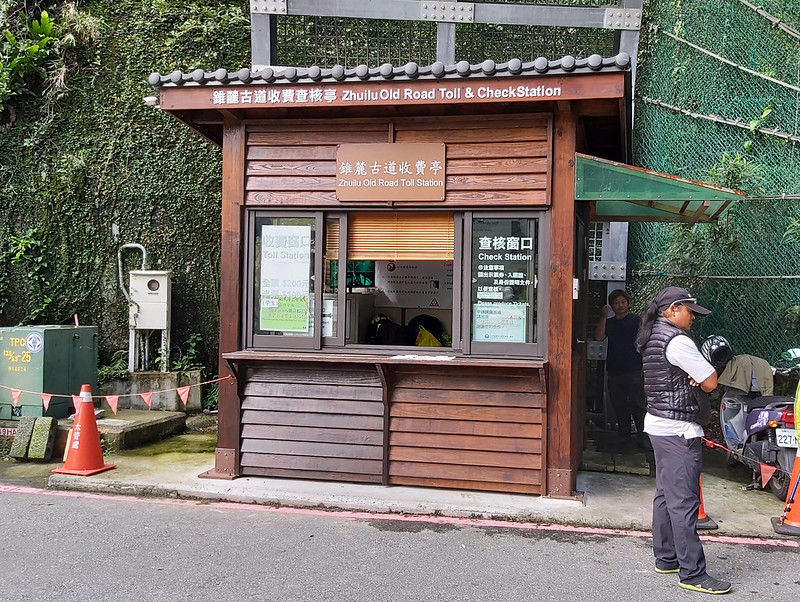
We got off car at Yanzikou, and our guides submitted our documents to the staff at the check station. The view
of Zhuilu Suspension Bridge and the newly renovated Shanyue Suspension
Bridge (aka Mountain Moon Bridge) 山月吊橋 was right in front of me. Like Zhuilu Old Trail, you also have to
apply permits if you want to walk on Shanyue Suspension Bridge.
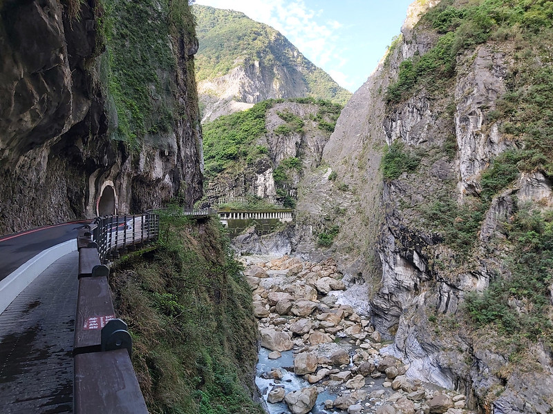
Spectacular Toilet Trip with Taroko Gorge and Stunning Suspension Bridges
Then, I saw the toilet sign and I decided to go. I can tell you this was the best toilet trip I've ever made.
Not only could I relieve myself, but also got to see one of the most remarkable works Mother Nature has ever
done.
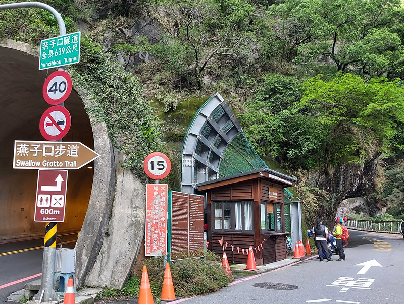
As you can imagine, this toilet trip took longer than it should be, because Taroko Gorge was so amazing. I
still can't find words to describe how stunning it is.
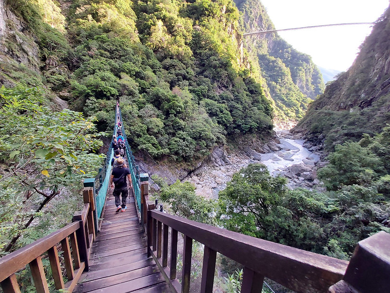
Finally, I remembered there was a great hike waiting for me. I got hurry to catch up with our group and cross
Zhuilu Suspension Bridge. I met some hikers who have a hard time to cross bridges like this. Lucky for me, I
had no problem with it.
A Gradual Uphill Hike with Knowledgeable Guides Sharing Stories from the Past
After crossing the suspension bridge, we went uphill. The trail terrain was in a good condition, not too
difficult to hike, and most of this part was shaded.
When we reached 1k mark attached on a huge boulder, the view opened up. Many of our hiking mates climbed up
the boulder to take photos.

Badagang Outpost
When I turned to the other side, I saw two door posts. Our guides told us those were the door posts of the old
Badagang Outpost 巴達岡駐在所, where the old village was. In Truku language, Badagang means Sweet Bamboo or Taiwan
giant bamboo 麻竹.
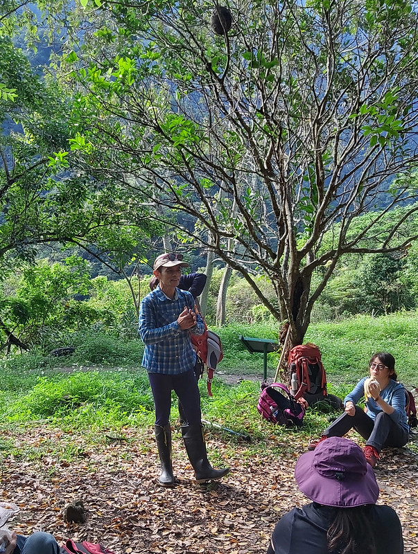
While we were taking a long break here, our guides who were also indigenous people, Brother Jin 金大哥 and Bada
巴達, told us stories about Zhuilu's history and the plants along the trail. They shared so many stories, but I
couldn't remember them all, which is a shame.
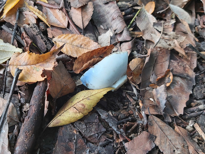
I looked around this area and still could see some foundation remains, a water stone tank, and even some
broken ceramics. I asked Bada about this, and he humbly told me that he wasn't that knowledgeable.
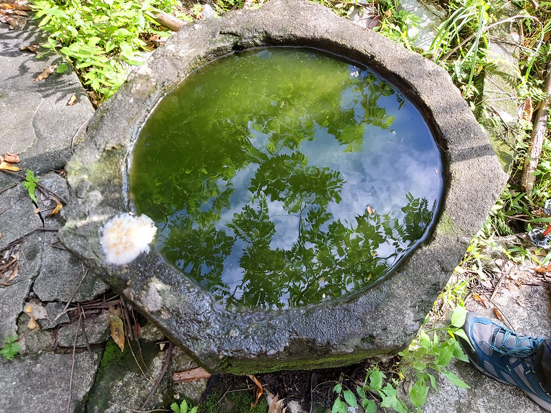
According to the sign, dormitory of Badagang Outpost was later remodeled as a hotel that could accommodate up
to 20 travelers.
Another sign explained about the blood-shed battles between Truku people and Japanese that happened more 100
years ago.
We also saw beautiful Rosepink Zephyrlily 韭蘭 at Badagang Outpost. You can click here to see more beautiful flowers I found on other trails.
After we resumed our hike, we quickly reached No. 2 Badagang Suspension Bridge 巴達岡二號橋 at 1.2 km mark. I tried
to take photos on the bridge.
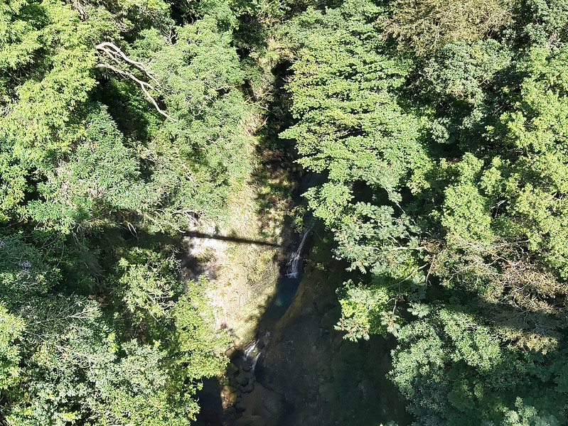
Perhaps our guides had explained where Zhuilu Suspension Bridge was, but I was too far away to hear it. Some
hikers said you can see it high up in the mountain when you cross Zhuilu Suspension Bridge. I think Foreigners in Taiwan might have found No. 1 Bridge.
Anyhow, views from both sides of No. 2 Badagang Bridge were great. Some people may find this scary.
The trail remained ascending gradually, and Bada stopped from time to time to explain the trees or plants to
us and also wait for slower hiking mates to catch up.
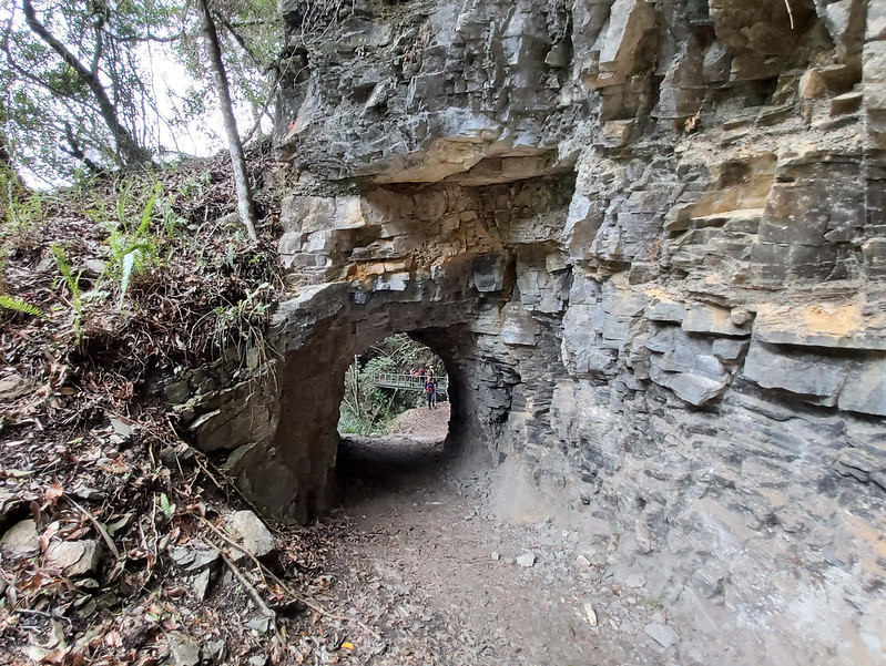
Then we reached a carved tunnel on a rock wall, and I could see a bridge, No. 1 Zhuilu Bridge 錐麓一號橋, through
the it. As you can imagine, this is a hot spot for taking photos.
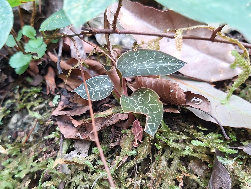
At somewhere on the trail, Bada stopped and pointed at a plant with intricated-pattern leaves saying this was
Anoectochilus formosanus Hayata 金線蓮, which is very popular in Taiwan for its medical benefits. That was why
Bada didn't want us to disclose its exact location. After doing research, this beautiful plant is actually an
orchid, and the flowers are so stunning. I'd love to see the flowers someday.
Finally, Walk along with the Cliffs above 700 Meters!
Within 10 minutes, we reached Zhuilu Cliffs, the section that would test my tolerance of height. Our guides
relentlessly reminded us of the danger we might face on this section and watching out our heads not to bump
into the rock walls, etc. They also reminded us not to lean on the handrails near the cliffs, which made me
even more nervous.
After finishing taking photos at the sign, we started our journey of cliff hike. The weather turned a little
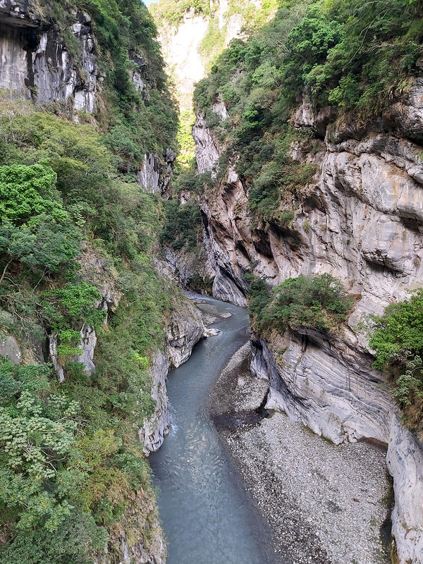
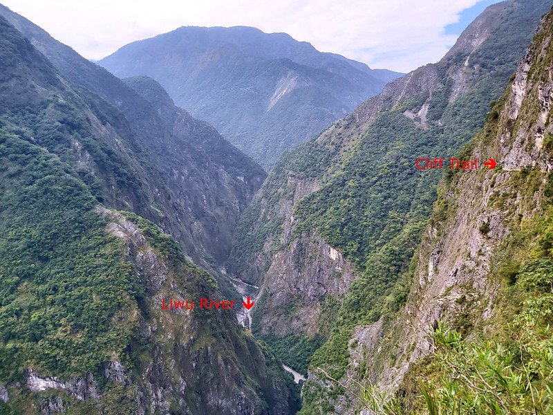
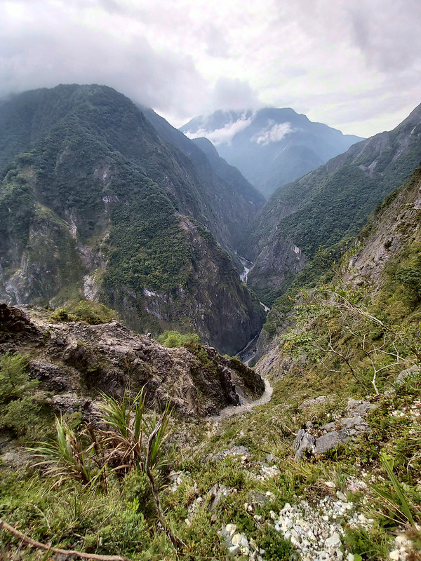
bit cloudy, but it didn't diminish the beauty of Taroko Gorge. The layers of mountains surrounding the deep
valley cut by Liwu River made the cliff trail look so small, but the trail was also a great contrast to the
winding river.
I tried very hard to watch out my steps without paying too much attention to the beautiful views around me. It
wasn't fun to lose my footing here, but I was Okay with the 150-cm wide trail.
However, it would be a totally different story if I had to walk on the trail with 30-cm width. According to
the previous description: “人人均捫壁蟹行,自始至終不敢交談”, meaning everyone had to lean on the cliff walls and walked like
crabs and none dared to talk from the beginning of the cliff section to the end. I don't think I would be able
to force my legs to move any tiny inch.
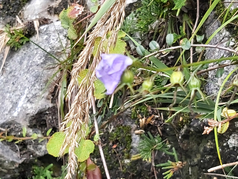
While walking on the trail, I noticed there were some beautiful flowers on the almost barren cliff walls. I
even found Taiwan Ladybell 玉山沙參, an endemic species in high mountains like Mt. Dabajian. Sorry for my blurred
photo. It wasn't easy to get a clear shot while I was on the cliff trail.
If you come here in May, June or July, you might also get to see a native species, Rosa pricei 太魯閣薔薇.
After the Taiwan Ladybell encounter, we reached a cave. Our guide Bada told us to check out the carvings on
the rock wall, which was done more than 100 years ago. The carving said, “大正四年、梅澤柾、開鑿、記念”, meaning "Taisho
Year 4 (1915), Mei Ze (Umezawa, Masa), Digging, Commemoration". You can use Google Translate to check out the
history about this.
I thought I would be very scared of the cliffs, but it turned out I was fine. There were several occasions
that I was temped to stick out my head to check out the deep valley, but I changed my mind at the last minute.
This was the best I dared to get.
This section was very short, the one-way trip was only 500 meters (547 yards). But some of my hiking mates
were still not able to deal with the visualization stimulus and got panic. After I followed the curved trail
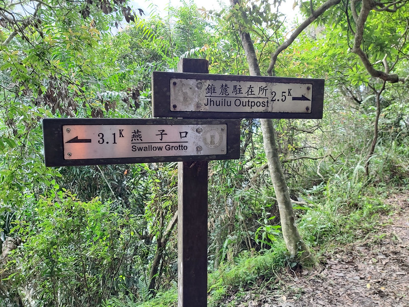
after 3.0k mark, I saw those signs pointing to different directions.
The Hike That Had to End Early
Then, we reached our destination, Cliff Outpost, and we had a lunch break here. I saw a sign saying Zhuilu
Outpost (it says Jhuilu Outpost on the sign) was 2.5 km away. It's pity that we couldn't hike further.
After lunch, it was time to head back to Zhuilu Suspension Bridge. It was difficult to say goodbye, and
looking at surrounding mountains let me want to do more trails in Hualien.

As mentioned earlier, the whole Zhuilu Old Trail was 10.3 km and a point-to-point trail, but many parts of the
trail are closed for safety reason. Some of my hiking friends hiked the whole trail a few years ago, and they
all told me that the other 7.2 km of Zhuilu Old Trail was amazing, which leaves me hanging. I don't know when
Taroko National Park will open the rest of the trail, but this is definitely on my Do It Again list.
Thoughts about This Hike: A Trail That Hasn't Finished Yet
Without a doubt, I definitely will visit Zhuilu Old Trail again, and hopefully I get to hike the total length
from Cimu Bridge to Zhuilu Suspension Bridge. The trail terrain might be more rugged on the Cimu Bridge side,
but I was told the views are even better.
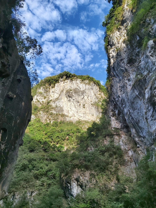
It's been a long time since my last visit of Taroko Gorge, and the beauty of this amazing place still takes my
breath away. If, unfortunately, the Cimu Bridge side is still not open to the public, you will have plenty of
time to visit other attractions in Toroko Gorge after the short Zhuilu Old Trail hike.
Two female hikers and I decided to visit Tunnel of Nine Turns 九曲洞 together before heading back to Hualien
Train Station, and it was so great to witness this geographic phenomenon that can only be found in Taiwan.
As to how scary it is to hike on Zhuilu Old Trail, the section of Zhuilu Cliffs isn't as scary as they are in
the photos, and there are handrails for you to cling to. If you only do the 3.1km trail, you can do it by
yourself without going with a group.
It's pity that I missed the 100+ year-old Guanyin Statue. I'm sure our guides had told us where the statue
was, but I might be too far away from them to hear that. After doing some research, the statue is located
inside a tunnel on the cliff section.
If you are really afraid of height or not sure whether you are fit enough for Zhuilu Old Trail, there are many
easier trails to enjoy in Taroko Gorge, like Shakandang Trail and Xiaozhuilu Trail.
Just visit Taroko Nation Park website to find out more.
Map and Itinerary
Route map for Zhuilu Old Trail In Taroko Gorge, Hualien, Taiwan by Anusha Lee on plotaroute.com
Click Menu in the map to download, print or share the map.
Click to change the speed to meet your
condition.
Note:
My GPS watch made some weird track so I have to use other hiker's track. Here's the source.
Click
 to change the speed to meet your
condition.
to change the speed to meet your
condition.Note:
My GPS watch made some weird track so I have to use other hiker's track. Here's the source.
Based on my hike on November 15, 2020
07:54
Arrived at Zhuilu Old Road Toll Station/Check Station near Yanzihkou
Tunnel. Took a toilet break and admired the beautiful gorge.
08:10
Started crossing Zhuilu Bridge
08:24
Passed 0.4k mark
08:22
Took a break at the big boulder
08:48
Reached the big boulder with 1k mark. Took photos and then passed the
door posts of the old Badangang Outpost.
08:55
Arrived at Badagang Village and took a long break
09:22
Reached No. 2 Badagang Suspension Bridge
09:38
Passed 1.6k mark
10:00
Passed 2k mark
10:30
Reached the cave and No. 1 Zhuilu Bridge
10:41
Reached the cliff at 2.6k and sign of warning
10:53
Reached the cave with the carving
11:06
Passed 3k mark
11:09
Reached Cliff Outpost and took a lunch break
12:00
Left Cliff Outpost and took the same trail back
12:24
Back to the No. 1 Zhuilu Bridge and the cave
13:23
Back to Badagang Outpost
14:03
Back to Yanzikou checkpoint
Total time:
6 hours 7 minutes, including long breaks


